Fains Veel
Airport details
| Country | France |
| State | Grand Est |
| Region | LF |
| Airspace | Reims Ctr |
| Municipality | Fains-Véel |
| Elevation | 827ft (252m) |
| Timezone | GMT +1 |
| Coordinates | 48.77760, 5.11001 |
| Magnetic var | |
| Type | land |
| Available since | X-Plane v10.40 |
| ICAO code | XLF000E |
| IATA code | n/a |
| FAA code | n/a |
Communication
| Fains Veel CTAF | 123.500 |
Nearby Points of Interest:
Collège Gilles-de-Trèves
-Hôtel de Marne
-Maison des deux Barbeaux
-Maison de la Gabbe
-Hôtel de la Bessière
-Hôtel de l'Escale
-Maison Morel
-Hôtel de Radouan
-Cadaver Tomb of René of Chalon
-Notre-Dame du Guet
-Château de la Forge
-Maison, 31 rue Émile Giros
-Maison, 17 rue Émile Giros (Saint-Dizier)
-Abbaye d'Écurey
-Fonderie du Val d'Osne
-étangs de la Champagne humide
-Synagogue of Saint-Mihiel
-hôpital Saint-Charles
-Maison renaissance, 1 rue des Juifs (Commercy)
-maison, 6 rue des Moulins
-Pharmacie Malard
-Ancien Hôtel de Ville
-Mairie d'Euville
-Hôtel de ville de Vitry-le-François
-Motte castrale de Chaillon
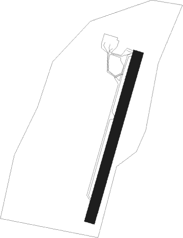
Runway info
| Runway 1 / 19 | ||
| length | 400m (1312ft) | |
| bearing | 30° / 210° | |
| width | 25m (82ft) | |
| surface | grass | |
Nearby beacons
| code | identifier | dist | bearing | frequency |
|---|---|---|---|---|
| SDI | SAINT DIZIER ROBINSON TACAN | 12.1 | 238° | 114 |
| CVT | CHALONS NDB | 31.3 | 269° | 347 |
| ETN | ETAIN NDB | 35 | 51° | 410 |
| NAY | NANCY OCHEY TACAN | 35.3 | 103° | 116.80 |
| MMD | MONTMEDY VOR | 36.8 | 1° | 109.40 |
| CAV | CHALONS VOR/DME | 38.1 | 270° | 111.65 |
| EPL | EPINAL MIRECOURT VOR | 46.7 | 116° | 113 |
| RLP | ROLAMPONT VOR/DME | 52.6 | 171° | 117.30 |
| WLU | LUXEMBOURG NDB | 60.2 | 50° | 346 |
Disclaimer
The information on this website is not for real aviation. Use this data with the X-Plane flight simulator only! Data taken with kind consent from X-Plane 12 source code and data files. Content is subject to change without notice.