Billy-sous-mangiennes - Billy Sous Mangiennes
Airport details
| Country | France |
| State | Grand Est |
| Region | |
| Airspace | Paris Ctr |
| Municipality | Billy-sous-Mangiennes |
| Elevation | 895ft (273m) |
| Timezone | GMT +1 |
| Coordinates | 49.32457, 5.60986 |
| Magnetic var | |
| Type | land |
| Available since | X-Plane v10.40 |
| ICAO code | XLF000G |
| IATA code | n/a |
| FAA code | n/a |
Communication
| Billy sous Mangiennes ATC Freq | 123.500 |
Nearby Points of Interest:
Hôtel de ville d'Étain
-Sous-préfecture de Verdun
-Remparts de Verdun
-Maison du Pape Jules II
-Verdun Town Hall
-Maison de l'Intendance
-Immeuble, 27 rue de la Paix
-Immeuble Noguez
-city walls of Longwy
-Hôtel de ville de Longwy
-puits couvert de Longwy
-Porte Châtel
-Pont-écluse Saint-Amand de Verdun
-Abbaye Saint-Vanne de Verdun
-Beffroi de Briey
-Mine de fer Bassompierre
-Nécropole mérovingienne d'Audun-le-Tiche
-Domaine de Clémarais, Aubange
-ermitage de Wachet
-église Saint-Pierre de Veymerange
-Ancienne église Saint-Hubert de Gandrange
-Château du Hof
-Château d'Auflance
-Synagogue of Thionville
-Autel de la Patrie
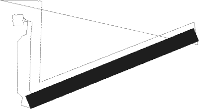
Runway info
| Runway 07 / 25 | ||
| length | 250m (820ft) | |
| bearing | 78° / 258° | |
| width | 20m (66ft) | |
| surface | grass | |
Nearby beacons
| code | identifier | dist | bearing | frequency |
|---|---|---|---|---|
| ETN | ETAIN NDB | 6.2 | 146° | 410 |
| MMD | MONTMEDY VOR | 19.4 | 278° | 109.40 |
| WLU | LUXEMBOURG NDB | 22.6 | 61° | 346 |
| MTZ | METZ NDB | 23.6 | 95° | 354 |
| LW | LUXEMBOURG NDB | 28 | 63° | 404 |
| LE | LUXEMBOURG NDB | 31.2 | 64° | 318 |
| LUX | LUXEMBOURG VOR/DME | 31.2 | 64° | 112.25 |
| LOU | LORRAINE NDB | 32.5 | 116° | 388 |
| ELU | LUXEMBOURG NDB | 36 | 65° | 368 |
| DIK | DIEKIRCH NDB | 38 | 44° | 307 |
| NAY | NANCY OCHEY TACAN | 46.4 | 155° | 116.80 |
| SDI | SAINT DIZIER ROBINSON TACAN | 50.1 | 226° | 114 |
| EMT | EPINAL NDB | 63.8 | 150° | 419 |
| BFS | FLORENNES TACAN | 66.3 | 314° | 111.50 |
Disclaimer
The information on this website is not for real aviation. Use this data with the X-Plane flight simulator only! Data taken with kind consent from X-Plane 12 source code and data files. Content is subject to change without notice.