Hannonville-sous-les-côtes - La Bertaucourt
Airport details
| Country | France |
| State | Grand Est |
| Region | |
| Airspace | Reims Ctr |
| Municipality | Labeuville |
| Elevation | 667ft (203m) |
| Timezone | GMT +1 |
| Coordinates | 49.07425, 5.75041 |
| Magnetic var | |
| Type | land |
| Available since | X-Plane v10.40 |
| ICAO code | XLF000I |
| IATA code | n/a |
| FAA code | n/a |
Communication
| La Bertaucourt ATC Freq | 123.500 |
Nearby Points of Interest:
Motte castrale de Chaillon
-Hôtel de ville d'Étain
-Gorze Abbey
-Abbaye de Sainte-Marie-au-Bois
-Menhir de Woinville
-Ossuaire d'Ancy-sur-Moselle
-Beffroi de Briey
-Synagogue of Saint-Mihiel
-Group Fortifications Of Saint-Quentin
-Remparts de Verdun
-maison du pasteur Paul Ferry
-Verdun Town Hall
-Maison du Pape Jules II
-Immeuble Noguez
-Sous-préfecture de Verdun
-Pont-écluse Saint-Amand de Verdun
-Porte Châtel
-Immeuble, 27 rue de la Paix
-Abbaye Saint-Vanne de Verdun
-University of Pont-à-Mousson
-Maison des Sept-Péchés-capitaux
-Hôtel de ville de Pont-à-Mousson
-Synagogue de Pont-à-Mousson
-Caserne Ney (Metz)
-Château Horgne de Montigny-lès-Metz
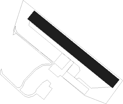
Runway info
| Runway 13 / 31 | ||
| length | 280m (919ft) | |
| bearing | 122° / 302° | |
| width | 30m (98ft) | |
| surface | grass | |
Nearby beacons
| code | identifier | dist | bearing | frequency |
|---|---|---|---|---|
| ETN | ETAIN NDB | 9.7 | 334° | 410 |
| LOU | LORRAINE NDB | 21 | 98° | 388 |
| MTZ | METZ NDB | 21.6 | 66° | 354 |
| NAY | NANCY OCHEY TACAN | 30.5 | 158° | 116.80 |
| MMD | MONTMEDY VOR | 31 | 297° | 109.40 |
| WLU | LUXEMBOURG NDB | 31.9 | 32° | 346 |
| LW | LUXEMBOURG NDB | 36.3 | 38° | 404 |
| GTQ | GROSTENQUIN VOR/DME | 38.3 | 95° | 111.25 |
| LE | LUXEMBOURG NDB | 39.1 | 41° | 318 |
| LUX | LUXEMBOURG VOR/DME | 39.1 | 41° | 112.25 |
| SDI | SAINT DIZIER ROBINSON TACAN | 42.9 | 243° | 114 |
| ELU | LUXEMBOURG NDB | 43.3 | 45° | 368 |
| EPL | EPINAL MIRECOURT VOR | 47 | 158° | 113 |
| EMT | EPINAL NDB | 47.8 | 149° | 419 |
| DIK | DIEKIRCH NDB | 49.5 | 26° | 307 |
| SPA | SPANGDAHLEM TACAN | 65.6 | 46° | 109.50 |
Disclaimer
The information on this website is not for real aviation. Use this data with the X-Plane flight simulator only! Data taken with kind consent from X-Plane 12 source code and data files. Content is subject to change without notice.