Eulmont - Grand Couronné
Airport details
| Country | France |
| State | Grand Est |
| Region | LF |
| Airspace | Reims Ctr |
| Municipality | Eulmont |
| Elevation | 1250ft (381m) |
| Timezone | GMT +1 |
| Coordinates | 48.76496, 6.21912 |
| Magnetic var | |
| Type | land |
| Available since | X-Plane v10.40 |
| ICAO code | XLF000O |
| IATA code | n/a |
| FAA code | n/a |
Communication
| Grand Couronné CTAF | 123.500 |
Nearby Points of Interest:
site archéologique d'Essey-Nancy
-Cure d'air Trianon
-La Douëra
-Daum
-Maison Fruhinsholzs
-Immeuble, 38 place de la Carrière
-maison Lecreulx
-immeuble, 10 rue des Sœurs-Macarons
-L'Excelsior
-Tour Joffre Saint-Thiébaut
-funiculaire de la Cure d'Air
-villa Fournier-Defaut
-papeterie de la Rochette
-château de l'abbé de Bouzey
-château de Lenoncourt
-grosse-maison de Villey-Saint-Étienne
-Synagogue de Delme
-Synagogue de Pont-à-Mousson
-Pont sur le Sânon
-Maison des Sept-Péchés-capitaux
-Hôtel de ville de Pont-à-Mousson
-University of Pont-à-Mousson
-Bois l'Évêque dolmen
-Couvent des Carmes de Vic-sur-Seille
-Château de Vic-sur-Seille
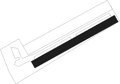
Runway info
| Runway 06 / 24 | ||
| length | 400m (1312ft) | |
| bearing | 73° / 253° | |
| width | 35m (115ft) | |
| surface | grass | |
Nearby beacons
| code | identifier | dist | bearing | frequency |
|---|---|---|---|---|
| LOU | LORRAINE NDB | 14.1 | 13° | 388 |
| NAY | NANCY OCHEY TACAN | 15.1 | 236° | 116.80 |
| GTQ | GROSTENQUIN VOR/DME | 23.7 | 66° | 111.25 |
| EMT | EPINAL NDB | 25.9 | 183° | 419 |
| EPL | EPINAL MIRECOURT VOR | 27.5 | 200° | 113 |
| MTZ | METZ NDB | 30.7 | 359° | 354 |
| ETN | ETAIN NDB | 35.1 | 310° | 410 |
| PHG | PHALSBOURG NDB | 38.8 | 90° | 424 |
| SAD | DME | 44.4 | 63° | 116.75 |
| WLU | LUXEMBOURG NDB | 48.6 | 348° | 346 |
| LW | LUXEMBOURG NDB | 50.9 | 357° | 404 |
| LE | LUXEMBOURG NDB | 52.5 | 2° | 318 |
| LUX | LUXEMBOURG VOR/DME | 52.5 | 2° | 112.25 |
| ELU | LUXEMBOURG NDB | 55.2 | 8° | 368 |
| LXI | LUXEUIL SAINT SAUVEUR TACAN | 59.2 | 172° | 108.20 |
| RLP | ROLAMPONT VOR/DME | 64.4 | 228° | 117.30 |
Disclaimer
The information on this website is not for real aviation. Use this data with the X-Plane flight simulator only! Data taken with kind consent from X-Plane 12 source code and data files. Content is subject to change without notice.