Sommevoire - Les Ailes Du Der
Airport details
| Country | France |
| State | Grand Est |
| Region | |
| Airspace | Paris Ctr |
| Municipality | Sommevoire |
| Elevation | 1839ft (561m) |
| Timezone | GMT +1 |
| Coordinates | 48.43706, 4.84886 |
| Magnetic var | |
| Type | land |
| Available since | X-Plane v10.40 |
| ICAO code | XLF000S |
| IATA code | n/a |
| FAA code | n/a |
Communication
| Les Ailes du Der ATC Freq | 123.500 |
Nearby Points of Interest:
hôtel de ville de Soulaines-Dhuys
-Pont Henri IV
-étangs de la Champagne humide
-Croix de Vallentigny
-Maison, 17 rue Émile Giros (Saint-Dizier)
-Maison, 31 rue Émile Giros
-Hôtel de ville de Brienne-le-Château
-Hôpital de la Charité de Brienne-le-Château
-Halles de Brienne-le-Château
-Hôtel de Ville de Bar-sur-Aube
-Fonderie du Val d'Osne
-Halle de Lesmont
-Clairvaux Abbey
-Château de la Forge
-Abbaye d'Écurey
-Hôtel de ville de Vitry-le-François
-halle de Piney
-église de Géraudot
-Mairie de Chaumont
-Chapelle du collège des Jésuites de Chaumont
-Halles de Chaumont
-Abbaye de la Crête
-Hôtel de Radouan
-Notre-Dame du Guet
-Cadaver Tomb of René of Chalon
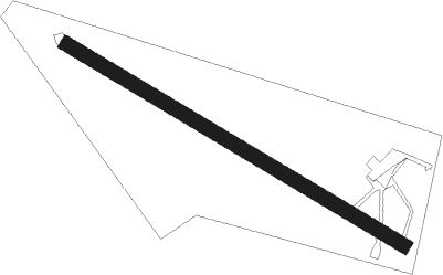
Runway info
| Runway 12 / 30 | ||
| length | 551m (1808ft) | |
| bearing | 115° / 295° | |
| width | 20m (66ft) | |
| surface | grass | |
| displ threshold | 0m (0ft) / 150m (492ft) | |
Nearby beacons
| code | identifier | dist | bearing | frequency |
|---|---|---|---|---|
| SDI | SAINT DIZIER ROBINSON TACAN | 12.1 | 11° | 114 |
| CVT | CHALONS NDB | 28.5 | 301° | 347 |
| TY | TROYES NDB | 33.7 | 268° | 320 |
| CAV | CHALONS VOR/DME | 34.6 | 296° | 111.65 |
| RLP | ROLAMPONT VOR/DME | 35.6 | 143° | 117.30 |
| TRO | TROYES BARBEREY VOR | 37 | 258° | 116 |
| VAT | CHALONS NDB | 39.5 | 293° | 367 |
| ETN | ETAIN NDB | 57.6 | 46° | 410 |
| MMD | MONTMEDY VOR | 58.3 | 16° | 109.40 |
| REM | REIMS VOR | 61.3 | 317° | 112.30 |
Disclaimer
The information on this website is not for real aviation. Use this data with the X-Plane flight simulator only! Data taken with kind consent from X-Plane 12 source code and data files. Content is subject to change without notice.