Girmont-val-d'ajol - Dropt
Airport details
| Country | France |
| State | Grand Est |
| Region | LF |
| Airspace | Reims Ctr |
| Municipality | Girmont-Val-d'Ajol |
| Elevation | 2040ft (622m) |
| Timezone | GMT +1 |
| Coordinates | 47.95840, 6.54102 |
| Magnetic var | |
| Type | land |
| Available since | X-Plane v10.40 |
| ICAO code | XLF0014 |
| IATA code | n/a |
| FAA code | n/a |
Communication
| Dropt ATC Freq | 123.500 |
Nearby Points of Interest:
Bain National de Plombières-les-Bains
-Thermes Napoléon de Plombières-les-Bains
-Grenier chalot de Saint-Bresson
-Copper mine at Le Thillot
-town hall of Servance-Miellin
-abbatial palace
-Luxeuil Abbey
-Moulin Gentrey
-Maison dite du Bailli
-Coal mine Sainte Marie
-Filature de Ronchamp
-Abbaye of Lure
-Musée Henri-Mathieu
-Hospice Marie-Richard
-Puits communal de Velotte
-Puits communal d'Amblans
-Château Lobstein
-château de Saulx
-Lavoir Buriot
-Grande fontaine
-Gendarmerie de Faverney
-Halles de Faverney
-Caserne de Faverney
-Château de Darney
-Hôtel de ville de Masevaux
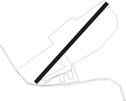
Runway info
| Runway 05 / 23 | ||
| length | 330m (1083ft) | |
| bearing | 58° / 238° | |
| width | 12m (39ft) | |
| surface | grass | |
| displ threshold | 26m (85ft) / 0m (0ft) | |
Nearby beacons
| code | identifier | dist | bearing | frequency |
|---|---|---|---|---|
| LXI | LUXEUIL SAINT SAUVEUR TACAN | 12.8 | 226° | 108.20 |
| LUL | LUXEUIL VOR | 19 | 222° | 117.10 |
| HR | HERICOURT NDB | 25 | 154° | 289 |
| EMT | EPINAL NDB | 26.4 | 317° | 419 |
| EPL | EPINAL MIRECOURT VOR | 28.9 | 307° | 113 |
| MB | MONTBELIARD NDB | 31.3 | 140° | 330 |
| HO | COLMAR-HOUSSEN NDB | 34.7 | 78° | 380 |
| BN | BASLE-MULHOUSE NDB | 41.8 | 108° | 353 |
| BLM | BASLE-MULHOUSE VOR/DME | 43.3 | 109° | 117.45 |
| BSV | BESANCON NDB | 43.7 | 206° | 370 |
| NAY | NANCY OCHEY TACAN | 44.3 | 317° | 116.80 |
| BS | BASLE-MULHOUSE NDB | 46.1 | 111° | 376 |
| LPS | LES EPLATURES NDB | 53.5 | 164° | 403 |
| PHG | PHALSBOURG NDB | 55.2 | 39° | 424 |
| GRE | GRENCHEN VOR/DME | 58.5 | 131° | 115.45 |
| SAV | SAVERNE VOR/DME | 61.9 | 47° | 110.45 |
Disclaimer
The information on this website is not for real aviation. Use this data with the X-Plane flight simulator only! Data taken with kind consent from X-Plane 12 source code and data files. Content is subject to change without notice.