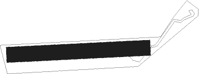
Bining
Airport details
| Country | France |
| State | Grand Est |
| Region | LF |
| Airspace | Reims Ctr |
| Municipality | Bining |
| Elevation | 1200ft (366m) |
| Timezone | GMT +1 |
| Coordinates | 49.04185, 7.23785 |
| Magnetic var | |
| Type | land |
| Available since | X-Plane v10.40 |
| ICAO code | XLF001A |
| IATA code | n/a |
| FAA code | n/a |
Communication
| Bining ATC Freq | 123.500 |
Nearby Points of Interest:
Hôtel de ville d'Oermingen
-Former Jewish school in Diemeringen
-Synagogue de Bitche
-Hôpital militaire de Bitche
-Protestantische Pfarrkirche
-Casino de la Faïencerie
-Maison au 1, rue des Potiers à Sarre-Union
-Maison au 29, rue du Couvent à Sarre-Union
-Maison, 1 rue des Tourneurs (Sarre-Union)
-Hôtel de ville de Sarre-Union
-Maison au 6, rue du Couvent à Sarre-Union
-Maison au 37, Grand'Rue à Sarre-Union
-Maison au 22, rue Frédéric-Flurer à Sarre-Union
-Maison au 25, Grand'Rue à Sarre-Union
-Château Teutsch
-Maison au 11, Grand'Rue à Sarre-Union
-Maison au 9, Grand'Rue à Sarre-Union
-Maison au 1, rue du Presbytère à Sarre-Union
-Jewish cemetery in Sarre-Union
-Maison au 14, rue de Verdun à Sarre-Union
-Maison au 16, rue de Verdun à Sarre-Union
-Maison au 25, rue de Verdun à Sarre-Union
-Maison, 27 rue de Verdun (Sarre-Union)
-Protestantische Kirche (Wolfersheim)
-Ancien hôtel de ville de Neusaarwerden
Nearby beacons
| code | identifier | dist | bearing | frequency |
|---|---|---|---|---|
| SR | ENSHEIM (SAARBRUECKEN) NDB | 10.5 | 354° | 360 |
| SAD | DME | 11.3 | 324° | 116.75 |
| ZWN | ZWEIBRUECKEN VOR/DME | 13.2 | 44° | 114.80 |
| PHG | PHALSBOURG NDB | 16.5 | 188° | 424 |
| SAV | SAVERNE VOR/DME | 16.9 | 139° | 110.45 |
| GTQ | GROSTENQUIN VOR/DME | 20.8 | 264° | 111.25 |
| RMS | RAMSTEIN TACAN | 27.2 | 42° | 113.40 |
| SE | STRASBOURG NDB | 33.1 | 134° | 412 |
| STR | STRASBOURG ENTZHEIM VOR/DME | 34.8 | 148° | 115.60 |
| KBA | KARLSRUHE/BADEN-BADEN NDB | 36.9 | 106° | 431 |
| KBD | DME | 37 | 107° | 115.80 |
| LOU | LORRAINE NDB | 38.1 | 267° | 388 |
| LRD | DME | 46.9 | 139° | 108.05 |
| LHR | LAHR NDB | 47.4 | 140° | 337 |
| ELU | LUXEMBOURG NDB | 51.5 | 306° | 368 |
| LE | LUXEMBOURG NDB | 52.8 | 301° | 318 |
| LUX | LUXEMBOURG VOR/DME | 52.8 | 301° | 112.25 |
| FHH | DME | 54 | 1° | 117.35 |
| HO | COLMAR-HOUSSEN NDB | 54.7 | 172° | 380 |
| HAN | HAHN NDB | 55.4 | 3° | 376 |
| SPA | SPANGDAHLEM TACAN | 60 | 330° | 109.50 |
Disclaimer
The information on this website is not for real aviation. Use this data with the X-Plane flight simulator only! Data taken with kind consent from X-Plane 12 source code and data files. Content is subject to change without notice.
