Zoufftgen
Airport details
| Country | France |
| State | Grand Est |
| Region | LH |
| Airspace | Reims Ctr |
| Municipality | Zoufftgen |
| Elevation | 750ft (229m) |
| Timezone | GMT +1 |
| Coordinates | 49.45111, 6.12357 |
| Magnetic var | |
| Type | land |
| Available since | X-Plane v10.40 |
| ICAO code | XLF001J |
| IATA code | n/a |
| FAA code | n/a |
Communication
| Zoufftgen ATC Freq | 123.500 |
Nearby Points of Interest:
Château du Hof
-Synagogue of Thionville
-église Saint-Pierre de Veymerange
-1, Avenue Albert 1er
-Autel de la Patrie
-pont des Alliés
-Nécropole mérovingienne d'Audun-le-Tiche
-Mine de fer Bassompierre
-Wintrange Castle
-Codex Mariendalensis
-Hospice Saint-Jean
-Former Clinique Saint-François in Luxembourg City
-Villa Louvigny
-St. Quirinus
-Palace of Nell
-Ancienne église Saint-Hubert de Gandrange
-Cemetery chapel Hostert (Niederanven)
-Belle-Croix d'Ennery
-Beffroi de Briey
-Domaine de Clémarais, Aubange
-Maison de l'Intendance
-puits couvert de Longwy
-city walls of Longwy
-Hôtel de ville de Longwy
-St. Nikolaus
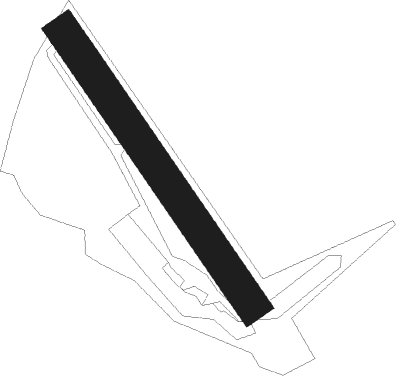
Runway info
| Runway 15 / 33 | ||
| length | 400m (1312ft) | |
| bearing | 138° / 318° | |
| width | 40m (131ft) | |
| surface | grass | |
Nearby beacons
| code | identifier | dist | bearing | frequency |
|---|---|---|---|---|
| WLU | LUXEMBOURG NDB | 7.5 | 329° | 346 |
| LW | LUXEMBOURG NDB | 9.8 | 17° | 404 |
| MTZ | METZ NDB | 11 | 154° | 354 |
| LUX | LUXEMBOURG VOR/DME | 12.2 | 33° | 112.25 |
| LE | LUXEMBOURG NDB | 12.3 | 33° | 318 |
| ELU | LUXEMBOURG NDB | 16.4 | 45° | 368 |
| ETN | ETAIN NDB | 22 | 244° | 410 |
| DIK | DIEKIRCH NDB | 24.6 | 1° | 307 |
| LOU | LORRAINE NDB | 27.8 | 162° | 388 |
| GTQ | GROSTENQUIN VOR/DME | 36.3 | 128° | 111.25 |
| SPA | SPANGDAHLEM TACAN | 38.7 | 47° | 109.50 |
| MMD | MONTMEDY VOR | 39.1 | 267° | 109.40 |
| SAD | DME | 41.4 | 104° | 116.75 |
| NAY | NANCY OCHEY TACAN | 52.5 | 191° | 116.80 |
| BUE | BUECHEL TACAN | 57 | 52° | 117.10 |
Disclaimer
The information on this website is not for real aviation. Use this data with the X-Plane flight simulator only! Data taken with kind consent from X-Plane 12 source code and data files. Content is subject to change without notice.