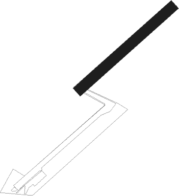
Soppe-le-bas - Soppe
Airport details
| Country | France |
| State | Grand Est |
| Region | LH |
| Airspace | Reims Ctr |
| Municipality | Soppe-le-Bas |
| Elevation | 1099ft (335m) |
| Timezone | GMT +1 |
| Coordinates | 47.72441, 7.09462 |
| Magnetic var | |
| Type | land |
| Available since | X-Plane v10.40 |
| ICAO code | XLF0024 |
| IATA code | n/a |
| FAA code | n/a |
Communication
| Soppe ATC Freq | 123.500 |
Nearby Points of Interest:
moulin de Bellemagny
-Abbaye de Masevaux
-Hôtel de ville de Masevaux
-Maison, 17 rue Curiale, Thann
-Maison Ehrhard
-Immeuble au 68, rue de la Première-Armée à Thann
-Maison à l'Ours noir
-Maison Moosbrugger
-Enceinte de Thann
-Immeuble au 4, rue du Temple à Thann
-Immeuble au 6, rue du Temple à Thann
-Halle aux blés
-Cimetière juif de Thann
-monument funéraire de Catherine Kos
-Remparts de Cernay
-remparts de Cernay
-Viaduc de Ballersdorf
-Synagogue of Foussemagne
-Salle des fêtes Grassegert
-Château de Heidwiller
-enceinte de Wattwiller
-old Saint-Martin church
-Nécropole nationale de Moosch
-Maison au 6, rue de la Vieille-Porte à Altkirch
-Porte de ville (Altkirch)
Nearby beacons
| code | identifier | dist | bearing | frequency |
|---|---|---|---|---|
| MB | MONTBELIARD NDB | 14.9 | 218° | 330 |
| BN | BASLE-MULHOUSE NDB | 15.9 | 99° | 353 |
| BLM | BASLE-MULHOUSE VOR/DME | 17.2 | 103° | 117.45 |
| HR | HERICOURT NDB | 17.6 | 246° | 289 |
| BS | BASLE-MULHOUSE NDB | 19.8 | 108° | 376 |
| HO | COLMAR-HOUSSEN NDB | 26.9 | 34° | 380 |
| HOC | DME | 27.8 | 114° | 113.20 |
| LXI | LUXEUIL SAINT SAUVEUR TACAN | 29.9 | 275° | 108.20 |
| LUL | LUXEUIL VOR | 32.3 | 267° | 117.10 |
| GRE | GRENCHEN VOR/DME | 35 | 149° | 115.45 |
| LPS | LES EPLATURES NDB | 40.3 | 205° | 403 |
| BSV | BESANCON NDB | 45.4 | 243° | 370 |
| WIL | WILLISAU VOR/DME | 46.4 | 124° | 116.90 |
| LHR | LAHR NDB | 47.2 | 49° | 337 |
| LRD | DME | 48.3 | 49° | 108.05 |
| STR | STRASBOURG ENTZHEIM VOR/DME | 50.6 | 31° | 115.60 |
| EMT | EPINAL NDB | 51.4 | 304° | 419 |
| FRI | FRIBOURG VOR/DME | 57.1 | 172° | 110.85 |
| SE | STRASBOURG NDB | 57.5 | 36° | 412 |
Disclaimer
The information on this website is not for real aviation. Use this data with the X-Plane flight simulator only! Data taken with kind consent from X-Plane 12 source code and data files. Content is subject to change without notice.
