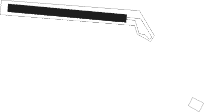
Le Portel - Boulogne Sur Mer
Airport details
| Country | France |
| State | Hauts-de-France |
| Region | LF |
| Airspace | Paris Ctr |
| Municipality | Le Portel |
| Elevation | 188ft (57m) |
| Timezone | GMT +1 |
| Coordinates | 50.69560, 1.56495 |
| Magnetic var | |
| Type | land |
| Available since | X-Plane v11.40 |
| ICAO code | XLF002C |
| IATA code | n/a |
| FAA code | n/a |
Communication
| Boulogne sur Mer ATC Freq | 123.500 |
Nearby beacons
| code | identifier | dist | bearing | frequency |
|---|---|---|---|---|
| ING | SAINT INGLEVERT NDB | 13.1 | 43° | 387 |
| BNE | BOULOGNE SUR MER VOR | 13.7 | 102° | 113.80 |
| MK | CALAIS-DUNKERQUE NDB | 25.8 | 58° | 418 |
| LZD | LYDD NDB | 28.5 | 293° | 397 |
| DVR | DOVER VOR/DME | 29.1 | 336° | 114.95 |
| LYD | LYDD VOR/DME | 31.7 | 294° | 114.05 |
| ABB | ABBEVILLE VOR/DME | 35.4 | 153° | 108.45 |
| HLS | DME | 44.2 | 297° | 115.95 |
| LSH | HEADCORN (LASHENDEN) NDB | 44.2 | 297° | 340 |
| DPE | DIEPPE VOR | 48.6 | 207° | 115.80 |
| DET | DETLING VOR/DME | 51.6 | 302° | 117.30 |
| DSA | DIEPPE NDB | 52.2 | 211° | 351 |
| SND | SOUTHEND NDB | 62.1 | 316° | 362 |
| GI | AMIENS NDB | 62.2 | 133° | 339 |
Disclaimer
The information on this website is not for real aviation. Use this data with the X-Plane flight simulator only! Data taken with kind consent from X-Plane 12 source code and data files. Content is subject to change without notice.
