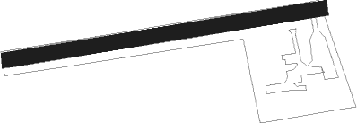
Saint-riquier-en-riviere - Le Mont Dolé
Airport details
| Country | France |
| State | Normandy |
| Region | LF |
| Airspace | Paris Ctr |
| Municipality | Saint-Riquier-en-Rivière |
| Elevation | 450ft (137m) |
| Timezone | GMT +1 |
| Coordinates | 49.89363, 1.57683 |
| Magnetic var | |
| Type | land |
| Available since | X-Plane v10.40 |
| ICAO code | XLF002T |
| IATA code | n/a |
| FAA code | n/a |
Communication
| Le Mont Dolé ATC Freq | 123.500 |
Nearby Points of Interest:
Abbaye Notre-Dame de Séry
-Moulin de Visse
-Briga
-Moulin de Saint-Maxent
-Abbaye Saint-Martin d'Auchy
-moulin à vent de Frucourt
-Ault lighthouse
-Croix de cimetière de Fontaine-en-Bray
-Château de Gaillefontaine
-manufacture des Rames
-Bains-douches d'Abbeville
-Chapelle Saint-Pierre Saint-Paul d'Abbeville
-Église Saint-Pierre de Cayeux-sur-Mer
-grenier à sel de Saint-Valery-sur-Somme
-Abri du Benoît-Champy
-Gate of Nevers
-Porte Guillaume
-Abbey of Saint Valery
-Cayeux-sur-Mer lighthouse
-Baie de Somme
-Croix de carrefour de La Crique
-Pont Colbert
-Collège des Oratoriens, Dieppe
-église Saint-Martin de Millencourt-en-Ponthieu
-Abbaye de Moreaucourt
Nearby beacons
| code | identifier | dist | bearing | frequency |
|---|---|---|---|---|
| DPE | DIEPPE VOR | 15.8 | 274° | 115.80 |
| ABB | ABBEVILLE VOR/DME | 18 | 49° | 108.45 |
| DSA | DIEPPE NDB | 19.1 | 269° | 351 |
| ROU | ROUEN VALLEE DE SEINE VOR | 28.1 | 215° | 116.80 |
| BV | BEAUVAIS NDB | 29.8 | 132° | 391 |
| GI | AMIENS NDB | 35.2 | 93° | 339 |
| BOV | BEAUVAIS TILLE VOR/DME | 35.4 | 128° | 109.65 |
| MTD | MONTDIDIER VOR | 40.9 | 110° | 113.65 |
| BNE | BOULOGNE SUR MER VOR | 45.7 | 24° | 113.80 |
| PON | PONTOISE CORMEILLES EN VE VOR | 51.1 | 150° | 111.60 |
| EVX | EVREUX FAUVILLE VORTAC | 53.5 | 202° | 112.40 |
| ING | SAINT INGLEVERT NDB | 59.7 | 9° | 387 |
| CGN | (PARIS) DME | 63.6 | 133° | 115.35 |
| BT | LE BOURGET (PARIS) VOR/DME | 64.9 | 136° | 116.10 |
Disclaimer
The information on this website is not for real aviation. Use this data with the X-Plane flight simulator only! Data taken with kind consent from X-Plane 12 source code and data files. Content is subject to change without notice.
