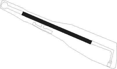
La Dominelais
Airport details
| Country | France |
| State | Brittany |
| Region | LF |
| Airspace | Brest Ctr |
| Municipality | La Dominelais |
| Elevation | 138ft (42m) |
| Timezone | GMT +1 |
| Coordinates | 47.75090, -1.65191 |
| Magnetic var | |
| Type | land |
| Available since | X-Plane v10.40 |
| ICAO code | XLF0039 |
| IATA code | n/a |
| FAA code | n/a |
Communication
| La Dominelais ATC Freq | 123.500 |
Nearby Points of Interest:
Maison
-Moulin de Pomméniac
-Château du Plessis-Bardoult
-château de la Raimbaudière
-Maison dite de l'Ange (Châteaubriant)
-Hôtel de la Houssaye
-Allée couverte de Tréal
-Menhir du Cas Rougé
-chapelle Sainte-Anne-du-Bois (Amanlis)
-Mine de Pont-Péan
-Pont de Pont-Réan
-Pont de Vaugon
-Gare de Bruz
-Croix du cimetière de Nouvoitou
-Couvent des Calvairiennes
-Chapelle Saint-Jean-Baptiste
-remparts de Redon
-manoir de la Sillandais
-Hôtel de Carmoy
-Hôtel de Richelieu
-Manoir du Mail
-chapelle du château de Châteaugiron
-Pigeonnier de Pouancé
-Rennes – Saint-Jacques Airport
-Fonts baptismaux de l'église de Maxent
Nearby beacons
| code | identifier | dist | bearing | frequency |
|---|---|---|---|---|
| REN | RENNES SAINT JACQUES VOR/DME | 19.4 | 344° | 109.25 |
| MT | SAINT NAZAIRE NDB | 29.6 | 223° | 398 |
| ANG | ANGERS VOR | 34.8 | 105° | 113 |
| NTS | NANTES ATLANTIQUE VOR/DME | 35.4 | 176° | 115.50 |
| LA | LAVAL NDB | 41.4 | 77° | 401 |
| GL | NANTES NDB | 41.9 | 183° | 369 |
| LP | CHOLET NDB | 49.5 | 127° | 357 |
| DIN | DINARD PLEURTUIT SAINT MA VOR/DME | 53 | 333° | 114.30 |
Disclaimer
The information on this website is not for real aviation. Use this data with the X-Plane flight simulator only! Data taken with kind consent from X-Plane 12 source code and data files. Content is subject to change without notice.
