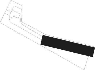
Liffré - La Baillée Sous Champ Fleu
Airport details
| Country | France |
| State | Brittany |
| Region | LH |
| Airspace | Brest Ctr |
| Municipality | Liffré |
| Elevation | 169ft (52m) |
| Timezone | GMT +1 |
| Coordinates | 48.18735, -1.49609 |
| Magnetic var | |
| Type | land |
| Available since | X-Plane v10.40 |
| ICAO code | XLF003A |
| IATA code | n/a |
| FAA code | n/a |
Communication
| La Baillée sous Champ Fleu ATC Freq | 123.500 |
Nearby Points of Interest:
Gare de Servon
-Menhirs dans la forêt de Haute-Sève
-calvaire du cimetière de Gahard
-Tombeau de saint Léonard
-Chaire de la collégiale Sainte-Marie-Madeleine de Champeaux (Ille-et-Vilaine)
-chapelle du château de Châteaugiron
-Caserne du Bon Pasteur
-Hôtel de Marbeuf
-Hôtel de Cuillé
-Hôtel Bonin de la Villebouquais
-Hôtel de Boisgeffroi
-Hôtel de Ferron
-Immeuble, 7 avenue Jean-Janvier
-Petit Hôtel de Chalain
-Hôtel de la Moussaye
-palais universitaire de Rennes
-Immeuble, 4 place du Parlement
-Hôtel de Robien
-Hôtel de Bretagne (Rennes)
-Immeuble, 10 place Sainte-Anne
-Rennes
-Maison, 19 place Sainte-Anne
-Immeuble, 18 place Sainte-Anne
-Immeuble, 17 place Sainte-Anne (Rennes)
-Gare de Saint-Médard-sur-Ille
Nearby beacons
| code | identifier | dist | bearing | frequency |
|---|---|---|---|---|
| REN | RENNES SAINT JACQUES VOR/DME | 12.1 | 244° | 109.25 |
| DIN | DINARD PLEURTUIT SAINT MA VOR/DME | 33.4 | 304° | 114.30 |
| LA | LAVAL NDB | 35.1 | 105° | 401 |
| ANG | ANGERS VOR | 46.9 | 135° | 113 |
| MT | SAINT NAZAIRE NDB | 55.8 | 213° | 398 |
Disclaimer
The information on this website is not for real aviation. Use this data with the X-Plane flight simulator only! Data taken with kind consent from X-Plane 12 source code and data files. Content is subject to change without notice.