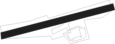
Selles Saint Denis
Airport details
| Country | France |
| State | Centre-Val de Loire |
| Region | LF |
| Airspace | Paris Ctr |
| Municipality | Selles-Saint-Denis |
| Elevation | 291ft (89m) |
| Timezone | GMT +1 |
| Coordinates | 47.39975, 1.91315 |
| Magnetic var | |
| Type | land |
| Available since | X-Plane v11.50 |
| ICAO code | XLF006E |
| IATA code | n/a |
| FAA code | n/a |
Communication
Nearby Points of Interest:
Château de La Ferté-Imbault
-Église Saint-Martin de Marcilly-en-Gault
-château de Rivaulde
-Usine Matra de Romorantin
-théâtre antique de Neung-sur-Beuvron
-Nançay Radio Telescope
-Abbaye Saint-Martin de Massay
-Tuilerie de la Bretèche
-mur d'enceinte du domaine national de Chambord
-chapelle du château de Chambord
-Pont Saint-Michel
-Château de Colliers
-Pont de Beaugency
-Ponts Chartrains
-Abbaye Notre-Dame de Beaugency
-Hôtel de Ville de Beaugency
-Église Saint-Étienne de Beaugency
-Viaduc ferroviaire de Beaugency
-Service inter-régional de traitement de l'information
-Hôtel de ville de Blois
-Collégiale Saint-Sauveur de Blois
-Palais de justice de Blois
-prieuré Saint-Lazare et hospice Lunier
-Prefecture hotel of Loir-et-Cher
-Chocolaterie Poulain in Blois
Nearby beacons
| code | identifier | dist | bearing | frequency |
|---|---|---|---|---|
| BRG | BOURGES NDB | 27.4 | 136° | 375 |
| CTX | CHATEAUROUX DEOLS NDB | 28.1 | 194° | 428 |
| BLB | BLOIS NDB | 33.1 | 291° | 397 |
| AMB | AMBOISE VOR/DME | 34.5 | 272° | 113.70 |
| ORS | ORLEANS SAINT DENIS DE L'HOTEL NDB | 34.9 | 32° | 322 |
| AMB | AMBOISE NDB | 35.4 | 271° | 341 |
| AVD | AVORD TACAN | 35.7 | 115° | 110.60 |
| BCY | ORLEANS VOR/DME | 35.7 | 345° | 117.35 |
| OAN | ORLEANS-BRICY NDB | 36.5 | 346° | 385 |
| AVD | AVORD NDB | 39.8 | 107° | 288 |
| CAD | CHATEAUDUN VOR/DME | 44.9 | 321° | 115.95 |
| CHN | CHATEAUDUN TACAN | 44.9 | 321° | 110.20 |
| PTV | PITHIVIERS VOR | 47.5 | 25° | 116.50 |
Disclaimer
The information on this website is not for real aviation. Use this data with the X-Plane flight simulator only! Data taken with kind consent from X-Plane 12 source code and data files. Content is subject to change without notice.