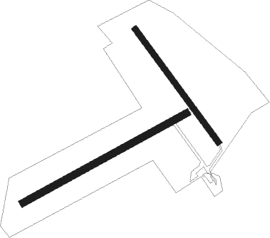
Orbigny - Orbigny Les Pallis
Airport details
| Country | France |
| State | Centre-Val de Loire |
| Region | LF |
| Airspace | Paris Ctr |
| Municipality | Orbigny |
| Elevation | 526ft (160m) |
| Timezone | GMT +1 |
| Coordinates | 47.21959, 1.27988 |
| Magnetic var | |
| Type | land |
| Available since | X-Plane v10.40 |
| ICAO code | XLF006G |
| IATA code | n/a |
| FAA code | n/a |
Communication
Nearby beacons
| code | identifier | dist | bearing | frequency |
|---|---|---|---|---|
| AMB | AMBOISE NDB | 15.3 | 310° | 341 |
| TUR | TOURS VAL DE LOIRE TACAN | 25.4 | 290° | 113.80 |
| CTX | CHATEAUROUX DEOLS NDB | 27.2 | 118° | 428 |
| BLB | BLOIS NDB | 27.4 | 350° | 397 |
| TUR | TOURS VAL DE LOIRE NDB | 29 | 305° | 331 |
| PI | POITIERS NDB | 47.3 | 239° | 363 |
| BCY | ORLEANS VOR/DME | 49.8 | 32° | 117.35 |
| CHN | CHATEAUDUN TACAN | 50.3 | 7° | 110.20 |
| CAD | CHATEAUDUN VOR/DME | 50.6 | 7° | 115.95 |
| OAN | ORLEANS-BRICY NDB | 50.9 | 32° | 385 |
| POI | POITIERS BIARDS VOR | 55.6 | 237° | 113.30 |
| ORS | ORLEANS SAINT DENIS DE L'HOTEL NDB | 58.1 | 53° | 322 |
| PTV | PITHIVIERS VOR | 68.8 | 46° | 116.50 |
Disclaimer
The information on this website is not for real aviation. Use this data with the X-Plane flight simulator only! Data taken with kind consent from X-Plane 12 source code and data files. Content is subject to change without notice.

