Reuilly
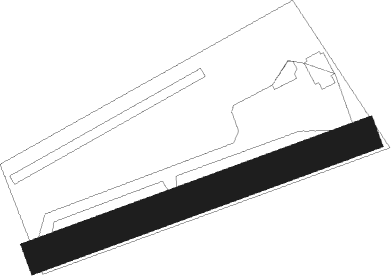
Airport details
| Country | France |
| State | Centre-Val de Loire |
| Region | LF |
| Airspace | Bordeaux Ctr |
| Municipality | Reuilly |
| Elevation | 495ft (151m) |
| Timezone | GMT +1 |
| Coordinates | 47.07512, 2.02408 |
| Magnetic var | |
| Type | land |
| Available since | X-Plane v10.40 |
| ICAO code | XLF0074 |
| IATA code | n/a |
| FAA code | n/a |
Communication
| Reuilly CTAF | 123.500 |
Nearby Points of Interest:
Abbaye Saint-Martin de Massay
-Bourges, Lycée Marguerite de Navarre
-Halle au blé de Bourges
-Hôtel-Dieu de Bourges
-Collège des Jésuites de Bourges
-Prefecture hotel of Cher
-hotel de panette - un chateau en ville
-abbaye Saint-Ambroix de Bourges
-Couvent des Augustins de Bourges
-Portail Saint-Ursin
-Palais archiépiscopal de Bourges
-Remparts gallo-romains de Bourges
-Église Saint-Denis de Condé
-Château de La Ferté-Imbault
-Nançay Radio Telescope
-Usine Matra de Romorantin
-Couvent des Cordeliers de Châteauroux
-Porte de Châteauroux
-Château du Parc
-château de Rivaulde
-Église Saint-Martin de Vallenay
-Église Saint-Amand de Saint-Denis-de-Palin
-Église Saint-Martin de Marcilly-en-Gault
-Château de Dun-sur-Auron
-Château de Maupas
Nearby beacons
| code | identifier | dist | bearing | frequency |
|---|---|---|---|---|
| BRG | BOURGES NDB | 11 | 103° | 375 |
| CTX | CHATEAUROUX DEOLS NDB | 12.3 | 238° | 428 |
| AVD | AVORD TACAN | 24.8 | 92° | 110.60 |
| AVD | AVORD NDB | 31.8 | 87° | 288 |
| NEV | NEVERS VOR | 37.2 | 85° | 113.40 |
| AV | AVORD NDB | 38.8 | 102° | 306 |
| AMB | AMBOISE VOR/DME | 44.5 | 290° | 113.70 |
| AMB | AMBOISE NDB | 45 | 289° | 341 |
| LPD | MONTLUCON-GUERET NDB | 48.1 | 158° | 398 |
| BLB | BLOIS NDB | 49 | 306° | 397 |
| ORS | ORLEANS SAINT DENIS DE L'HOTEL NDB | 52.5 | 14° | 322 |
| BCY | ORLEANS VOR/DME | 55.7 | 344° | 117.35 |
| OAN | ORLEANS-BRICY NDB | 56.5 | 345° | 385 |
| CAD | CHATEAUDUN VOR/DME | 64.4 | 327° | 115.95 |
| CHN | CHATEAUDUN TACAN | 64.4 | 327° | 110.20 |
Disclaimer
The information on this website is not for real aviation. Use this data with the X-Plane flight simulator only! Data taken with kind consent from X-Plane 12 source code and data files. Content is subject to change without notice.