Airports for X-Plane offers a convenient way to explore airports and their related communication information for the X-Plane flight simulator. It only uses data from the X-Plane flight simulator itself, and is therefore more reliable than the data that comes from real aviation websites. You can search for airports by using the ICAO code, or browse for airports per country and state. The information displayed is categorized by airport details, runway information, airport communication, approach frequencies (ILS and Glidepath details), details of nearby beacons, SIDs, STARs and approach procedures.

aircraft aircraft carrier public transport field runway helicopters nation airdrome airport check-in landing area airstrip international outskirts airport apron flight attendant propeller plane pilot airport flight terminal

Chaume Et Courchamp

Airport details

CountryFrance
StateBourgogne-Franche-Comté
RegionLF
AirspaceReims Ctr
MunicipalityDijon
Elevation930ft (283m)
TimezoneGMT +1
Coordinates47.57392, 5.34931
Magnetic var
Typeland
Available sinceX-Plane v11.50
ICAO codeXLF007Z
IATA coden/a
FAA coden/a

Communication

No airport communication available for XLF007Z
Nearby Points of Interest:
Bèze Abbey
-
Château de Champlitte
-
Couvent des Augustins de Champlitte
-
Fontaine-lavoir sud
-
maison Davadan
-
Croix de cimetière de Verseilles-le-Haut
-
Abbaye royale de Belmont
-
Entrepôts Anthony
-
Gray
-
Vestiges préhistoriques du bois de Vergentière
-
Croix de carrefour de Brennes
-
Mairie-lavoir de Beaujeu
-
ferme de l'abbaye Notre-Dame de Corneux
-
ruines romaines de Membrey
-
fontaine de la Grenouille
-
remparts de Langres
-
Prieuré de La Roche-Morey
-
Ermitage Sainte-Cécile de Valay
-
Sculptures du campus de l'université de Bourgogne
-
Hôtel de Saulx
-
Hôtel de Noident
-
Villa Pernot
-
Hôtel Coeurderoy
-
hôtel de Pourlans
-
Hôtel du Commandant militaire

Runway info

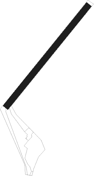
Runway 04 / 22
 length601m (1972ft)
 bearing55° / 235°
 width30m (98ft)
 surfacegrass

Airport layout


Nearby beacons

codeidentifierdistbearingfrequency
RLPROLAMPONT VOR/DME20.3343°117.30
DJLDIJON LONGVIC VOR/DME20.8220°111.45
DODOLE NDB35.7184°309
LULLUXEUIL VOR38.983°117.10
BSVBESANCON NDB39.2110°370
EPLEPINAL MIRECOURT VOR5344°113
CCCHAMPFORGEUIL NDB55.2211°391
EMTEPINAL NDB56.848°419

Disclaimer

The information on this website is not for real aviation. Use this data with the X-Plane flight simulator only! Data taken with kind consent from X-Plane 12 source code and data files. Content is subject to change without notice.