Airports for X-Plane offers a convenient way to explore airports and their related communication information for the X-Plane flight simulator. It only uses data from the X-Plane flight simulator itself, and is therefore more reliable than the data that comes from real aviation websites. You can search for airports by using the ICAO code, or browse for airports per country and state. The information displayed is categorized by airport details, runway information, airport communication, approach frequencies (ILS and Glidepath details), details of nearby beacons, SIDs, STARs and approach procedures.

airbase southwest airport apron landing area aerodrome heliport station tarmac bus international concrete air terminal buildings airplane aerodromes landing airstrip capital flown airfield traffic pattern

Chamboeuf - Chazan

Airport details

CountryFrance
StateBourgogne-Franche-Comté
RegionLF
AirspaceReims Ctr
MunicipalityChambœuf
Elevation1516ft (462m)
TimezoneGMT +1
Coordinates47.21624, 4.90370
Magnetic var
Typeland
Available sinceX-Plane v11.50
ICAO codeXLF0081
IATA coden/a
FAA coden/a

Communication

Chazan CTAF123.500
Nearby Points of Interest:
Lavoir de Fixin
-
Château de Gilly-lès-Cîteaux
-
Beffroi de Nuits-Saint-Georges
-
Hospices de Nuits-Saint-Georges
-
Hospices de Dijon
-
Bastion de Guise
-
Couvent des Carmes de Dijon
-
maison Creusot
-
hospice Sainte-Anne
-
hôtel de Ruffey
-
Petit Hôtel Berbisey
-
Monastère des Bernardines de Dijon
-
Grand Hôtel Berbisey
-
Hôtel Petit de Ruffey
-
Hôtel d'Esterno
-
Hôtel de la Mare
-
Kiosque à musique place Wilson
-
Hôtel Brûlart
-
Couvent des Cordeliers de Dijon
-
Hôtel de Migieu
-
Hôtel Perreney de Baleure
-
Villa Vurpillot
-
Hôtel de Sassenay
-
palais abbatial Saint-Bénigne
-
Abbaye de Saint-Bénigne

Runway info

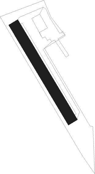
Runway 15 / 33
 length200m (656ft)
 bearing144° / 324°
 width20m (66ft)
 surfacegrass

Airport layout


Nearby beacons

codeidentifierdistbearingfrequency
DJLDIJON LONGVIC VOR/DME8.574°111.45
DODOLE NDB21.7121°309
CCCHAMPFORGEUIL NDB29.8187°391
RLPROLAMPONT VOR/DME43.727°117.30
SNSAINT YAN NDB64220°430

Disclaimer

The information on this website is not for real aviation. Use this data with the X-Plane flight simulator only! Data taken with kind consent from X-Plane 12 source code and data files. Content is subject to change without notice.