Lacave - Lacave Le Frau
Airport details
| Country | France |
| State | Occitania |
| Region | LF |
| Airspace | Bordeaux Ctr |
| Municipality | Lacave |
| Elevation | 979ft (298m) |
| Timezone | GMT +1 |
| Coordinates | 44.84370, 1.58513 |
| Magnetic var | |
| Type | land |
| Available since | X-Plane v10.40 |
| ICAO code | XLF4623 |
| IATA code | n/a |
| FAA code | n/a |
Communication
| Lacave le Frau ATC Freq | 123.500 |
Nearby Points of Interest:
Château de la Treyne
-Basilique Saint-Sauveur de Rocamadour
-Maison Arcambal
-Hôtel Fabri
-Hôtel de ville de Martel
-Dolmen des Plassous
-fontaine de l'Oulié
-Pigeonnier-porche de Lavergne
-Dolmen de la Baune
-Pont de Maday
-château de Cavagnac
-Hôpital des religieuses de Beaulieu
-Maison Cavaignac
-Tour-pigeonnier de Labio
-Manor d'Eyrignac
-Immeuble du Bessol
-Pech de l’Azé
-Chapelle monolithe de Caudon
-Abbaye Nouvelle (Léobard, France)
-Donjon de Jayac
-Couvent Notre-Dame, Sarlat-la-Canéda
-Lanterne des morts de Sarlat-la-Canéda
-Hôtel de Vienne
-Manoir de Gisson
-Monastère des Récollets
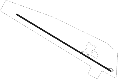
Runway info
| Runway 13 / 31 | ||
| length | 698m (2290ft) | |
| bearing | 117° / 297° | |
| width | 9m (28ft) | |
| surface | asphalt | |
| displ threshold | 12m (39ft) / 55m (180ft) | |
Nearby beacons
| code | identifier | dist | bearing | frequency |
|---|---|---|---|---|
| BSC | SOUILLAC (BRIVE) NDB | 9.2 | 14° | 351 |
| FC | FIGEAC LIVERNON NDB | 13.4 | 131° | 395 |
| CL | CAHORS NDB | 28.4 | 200° | 348 |
| AR | AURILLAC NDB | 33.9 | 82° | 343 |
| PX | PERIGUEUX NDB | 34.5 | 296° | 389 |
| BGC | BERGERAC NDB | 41.1 | 269° | 374 |
| RZ | RODEZ NDB | 44 | 116° | 387 |
| TLB | TOULOUSE NDB | 54.2 | 189° | 368 |
| GAI | GAILLAC VOR | 54.4 | 165° | 115.80 |
| AG | AGEN NDB | 57 | 233° | 400 |
| AB | ALBI NDB | 59.5 | 153° | 323 |
| LSU | LIMOGES NDB | 59.9 | 333° | 320 |
| LMG | LIMOGES VOR/DME | 62.9 | 330° | 114.50 |
| AGN | AGEN VOR/DME | 65 | 217° | 114.80 |
Disclaimer
The information on this website is not for real aviation. Use this data with the X-Plane flight simulator only! Data taken with kind consent from X-Plane 12 source code and data files. Content is subject to change without notice.