La Tranche Sur Mer
Airport details
| Country | France |
| State | Pays de la Loire |
| Region | LF |
| Airspace | Bordeaux Ctr |
| Municipality | La Tranche-sur-Mer |
| Elevation | 16ft (5m) |
| Timezone | GMT +1 |
| Coordinates | 46.36734, -1.42799 |
| Magnetic var | |
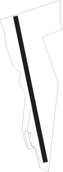
| Type | land |
| Available since | X-Plane v10.40 |
| ICAO code | XLF8522 |
| IATA code | n/a |
| FAA code | n/a |
Communication
| La Tranche sur Mer CTAF | 123.500 |
| La Tranche sur Mer LA ROCHELLE Approach | 124.200 |
| La Tranche sur Mer Dep | 123.500 |
Nearby Points of Interest:
Croix hosannière de La Jonchère
-menhirs du champ de la Pierre
-Abbaye royale de Saint-Michel-en-l'Herm
-Ponts du Port-la-Claye
-Saint Catherine Church of Loix
-demeure, 19, 25 rue des Gabarets
-Citadel of Saint-Martin-de-Ré
-enceinte de Saint-Martin-de-Ré
-hôtel des Cadets
-hôpital Saint-Honoré
-Category:Palais épiscopal (Luçon)
-domaine du Portail
-Prieuré de Sermaize
-Château de Pierre-Levée
-Porte Dauphine, La Rochelle
-Villa Mirasol (Les Sables d'Olonne)
-Villa Blanche
-Villa Alsace, La Rochelle
-Hôtel du Commerce
-Vauclair castle
-Hôtel de Craon
-hôtel d'Orbigny-Bernon
-Maison au Chien
-Maison Henri II de La Rochelle
-Palais de justice de La Rochelle
Nearby beacons
| code | identifier | dist | bearing | frequency |
|---|---|---|---|---|
| RL | LA ROCHELLE NDB | 17.8 | 120° | 322 |
| YN | LA ROCHE SUR YON LES AJONCS NDB | 20.1 | 24° | 334 |
| ROC | ROCHEFORT NDB | 34.1 | 137° | 396 |
| GL | NANTES NDB | 42.5 | 339° | 369 |
| NTS | NANTES ATLANTIQUE VOR/DME | 48.2 | 347° | 115.50 |
| RY | ROYAN NDB | 50.8 | 143° | 427 |
| LP | CHOLET NDB | 52 | 37° | 357 |
| MT | SAINT NAZAIRE NDB | 63.3 | 327° | 398 |
Disclaimer
The information on this website is not for real aviation. Use this data with the X-Plane flight simulator only! Data taken with kind consent from X-Plane 12 source code and data files. Content is subject to change without notice.