Marathon - Kotroni
Airport details
| Country | Greece |
| State | Attica |
| Region | LG |
| Airspace | Athens Ctr |
| Municipality | Municipality of Marathonas |
| Elevation | 679ft (207m) |
| Timezone | GMT +2 |
| Coordinates | 38.13770, 23.95153 |
| Magnetic var | |
| Type | land |
| Available since | X-Plane v10.40 |
| ICAO code | XLG0004 |
| IATA code | n/a |
| FAA code | n/a |
Communication
| Kotroni Tower | 128.700 |
| Kotroni Approach | 120.900 |
Nearby Points of Interest:
Omorfokklisia
-Mone Asteriou
-Queen's Tower
-Brauron
-Koutouki Cave
-Lapathiotis House
-Livieratos Mansion
-Averof building
-Sarogleio Mansion
-Athens trilogy
-Hall of the Academy of Athens
-Old Royal Palace
-Agii Theodori (Athens)
-Athens City Hall
-tempi hotel
-Palamas house
-Gasparis house
-Church House
-Agios Ioannis Theologos (Athens)
-Old Temple of Athena
-Chalkotheke
-Brauroneion
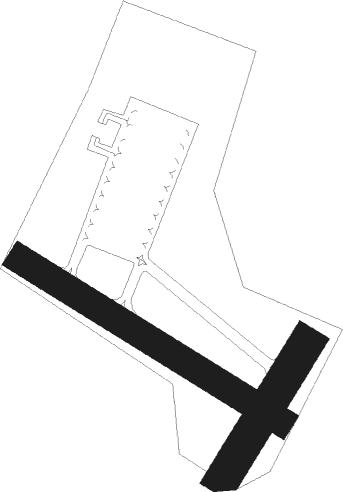
Runway info
Runway 12 / 30  | ||
| length | 599m (1965ft) | |
| bearing | 120° / 300° | |
| width | 55m (180ft) | |
| surface | asphalt | |
| Runway 03 / 21 | ||
| length | 308m (1010ft) | |
| bearing | 43° / 223° | |
| width | 68m (223ft) | |
| surface | asphalt | |
Nearby beacons
| code | identifier | dist | bearing | frequency |
|---|---|---|---|---|
| SPA | ATHENS VOR/DME | 13.2 | 184° | 117.50 |
| SAT | ATHENS VOR/DME | 13.3 | 190° | 109.60 |
| TNG | TANAGRA NDB | 15.2 | 311° | 303 |
| ATV | ATHENS VOR/DME | 16.4 | 211° | 114.40 |
| ELF | ELEFSIS TACAN | 19 | 260° | 108.20 |
| LEF | ELEFSIS VOR/DME | 19.1 | 259° | 109.85 |
| TGG | TANAGRA VOR/DME | 22.1 | 297° | 111.80 |
| TGR | TANAGRA TACAN | 24.1 | 296° | 108.40 |
| KRO | KARISTOS VOR/DME | 27.1 | 105° | 112.20 |
| MGR | MEGARA NDB | 29.6 | 255° | 405 |
| EGN | AIGINA NDB | 33.4 | 235° | 382 |
| KEA | KEA VOR/DME | 38.5 | 149° | 115 |
| DDM | DIDIMON VOR/DME | 52.7 | 228° | 117.20 |
| SKY | SKYROS TACAN | 56.3 | 33° | 116.10 |
| SKS | SKIROS VOR/DME | 56.4 | 33° | 116.60 |
| SYR | SYROS NDB | 63.8 | 126° | 417 |
Disclaimer
The information on this website is not for real aviation. Use this data with the X-Plane flight simulator only! Data taken with kind consent from X-Plane 12 source code and data files. Content is subject to change without notice.