San Zenone Al Po - Aviosuperficie Speziana
Airport details
| Country | Italy |
| State | Lombardy |
| Region | |
| Airspace | Milan Ctr |
| Municipality | San Zenone al Po |
| Elevation | 180ft (55m) |
| Timezone | GMT +1 |
| Coordinates | 45.12829, 9.36403 |
| Magnetic var | |
| Type | land |
| Available since | X-Plane v10.32 |
| ICAO code | XLI0008 |
| IATA code | n/a |
| FAA code | n/a |
Communication
Nearby Points of Interest:
Costa de' Nobili
-Bosnasco
-San Zenone al Po
-San Damiano al Colle
-Stradella
-Linarolo
-Santa Giuletta
-Zenevredo
-Albaredo Arnaboldi
-San Giovanni Battista church
-Villanterio
-Ponte della Becca
-Montù Beccaria
-Graffignana
-Sant'Angelo Lodigiano
-Borghetto Lodigiano
-Pinarolo Po
-Barbianello
-Maggi Pizzagalli Palace
-Cigognola
-Castello di Seminò
-Lardirago
-Santa Maria della Versa
-San Francesco di Paola Church
-Palazzo Mezzabarba
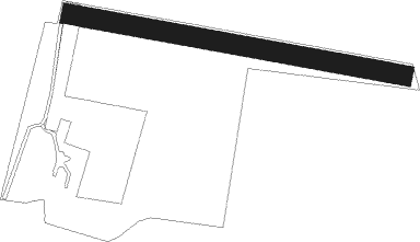
Runway info
| Runway 12 / 30 | ||
| length | 504m (1654ft) | |
| bearing | 101° / 281° | |
| width | 30m (98ft) | |
| surface | grass | |
| blast zone | 10m (33ft) / 4m (13ft) | |
Nearby beacons
| code | identifier | dist | bearing | frequency |
|---|---|---|---|---|
| COD | CODOGNO NDB | 9.5 | 61° | 400 |
| LNE | LINATE (MILAN) NDB | 13.3 | 341° | 386 |
| VOG | VOGHERA NDB | 19.3 | 247° | 333 |
| PIA | PIACENZA TACAN | 19.7 | 121° | 117.40 |
| LIN | LINATE (MILAN) VOR/DME | 20.3 | 345° | 112.25 |
| TZO | TREZZO NDB | 26.5 | 19° | 345 |
| NOV | NOVARA (MILAN) NDB | 29.9 | 297° | 292 |
| SRN | SARONNO VOR/DME | 34.2 | 327° | 113.70 |
| SRN | SARONNO NDB | 34.3 | 327° | 330 |
| BEG | BERGAMO VOR/DME | 35.6 | 33° | 114.95 |
| MAL | MALPENSA (MILAN) NDB | 35.8 | 304° | 364 |
| ORI | ORIO AL SERIO (BERGAMO) NDB | 36.9 | 43° | 376 |
| CAM | CAMERI TACAN | 39.9 | 302° | 115 |
| MMP | MALPENSA (MILAN) NDB | 40.5 | 309° | 425 |
| MMP | MALPENSA (MILAN) VOR/DME | 40.6 | 309° | 113.35 |
| GHE | GHEDI TACAN | 42.3 | 71° | 110.90 |
| GEN | GENOA NDB | 43.9 | 202° | 318 |
| BSA | BRESCIA VOR/DME | 44.3 | 72° | 117.70 |
| SES | SESTRI (GENOA) VOR/DME | 48.5 | 217° | 108.60 |
Disclaimer
The information on this website is not for real aviation. Use this data with the X-Plane flight simulator only! Data taken with kind consent from X-Plane 12 source code and data files. Content is subject to change without notice.