Montagnana - Aviosuperficie Montagnana
Airport details
| Country | Italy |
| State | Veneto |
| Region | |
| Airspace | Milan Ctr |
| Municipality | Montagnana |
| Elevation | 16ft (5m) |
| Timezone | GMT +1 |
| Coordinates | 45.24687, 11.42090 |
| Magnetic var | |
| Type | land |
| Available since | X-Plane v10.32 |
| ICAO code | XLI000Q |
| IATA code | n/a |
| FAA code | n/a |
Communication
| Aviosuperficie Montagnana Montagnana | 118.975 |
Nearby Points of Interest:
Tombola archaeological site
-Santa Maria Addolorata e San Giovanni Battista
-Archaeologic musuem of Castelnovo Bariano
-Gorghi di Trecenta
-Museo di archeologia e scienze naturali Giuseppe Zannato
-Museo etnografico della civiltà e del lavoro in Polesine
-Oasi Bojo della Ferriana (Concadirame, Rovigo)
-Annunciazione della Beata Vergine Maria
-Archeological Museum of Isola della Scala
-Santa Maria Assunta
-historic center of Vicenza
-City of Vicenza and the Palladian Villas of the Veneto
-Chiesa di San Martino Vescovo
-San Lorenzo Church
-Poggio Rusco
-Schivenoglia
-San Domenico al Corso
-Museum of Precinema
-Verona
-Domus romana di piazza Castelvecchio
-Capitular Library of Verona
-University Library of Padua
-Chiesa di San Giovanni
-Amphitheatre of Padua
-Padua's fourteenth-century fresco cycles
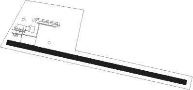
Runway info
| Runway 11 / 29 | ||
| length | 1116m (3661ft) | |
| bearing | 102° / 282° | |
| width | 30m (98ft) | |
| surface | grass | |
| displ threshold | 97m (318ft) / 170m (558ft) | |
Nearby beacons
| code | identifier | dist | bearing | frequency |
|---|---|---|---|---|
| IPD | DME-ILS | 19.9 | 71° | 111.30 |
| VIL | VILLAFRANCA VORTAC | 23.7 | 287° | 115.80 |
| VIC | VICENZA NDB | 25.7 | 33° | 417 |
| VIC | VICENZA VOR/DME | 25.8 | 33° | 113.40 |
| TRE | TREVISO NDB | 36.2 | 61° | 301 |
| CHI | CHIOGGIA NDB | 37.9 | 101° | 408 |
| ISA | ISTRANA TACAN | 39.4 | 58° | 111.70 |
| TEV | DME-ILS | 40.1 | 62° | 108.55 |
| BOA | BOLOGNA VOR/DME | 42.9 | 190° | 117.10 |
| TES | TESSERA VOR/DME | 43.1 | 74° | 115.30 |
| TNT | TRENTO VOR/DME | 47.9 | 340° | 115.35 |
Disclaimer
The information on this website is not for real aviation. Use this data with the X-Plane flight simulator only! Data taken with kind consent from X-Plane 12 source code and data files. Content is subject to change without notice.