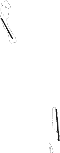
Artena - Aviosuperficie Artena
Airport details
| Country | Italy |
| State | Lazio |
| Region | |
| Airspace | Rome Ctr |
| Municipality | Artena |
| Elevation | 660ft (201m) |
| Timezone | GMT +1 |
| Coordinates | 41.69782, 12.83368 |
| Magnetic var | |
| Type | land |
| Available since | X-Plane v10.32 |
| ICAO code | XLI001G |
| IATA code | n/a |
| FAA code | n/a |
Communication
Nearby Points of Interest:
Ariccia Bridge
-Palazzo Savelli (Albano Laziale)
-Museo del cioccolato
-Loggia dei Mercanti
-Church of Saint Joseph
-ponte Lupo Acqua Rossa
-chiesa di Santa Margherita
-Antiquarium Lucrezia Romana
-Aqua Marcia
-Anio Novus
-Aqua Claudia
-chiesa di Santa Maria Assunta
-parco archeologico Appia antica - tombe della via Latina
-Museo delle Civiltà
-Monastery of Saint Scholastica
-Palazzo Altemps
-Villa Giustiniani Massimo
-Biblioteca universitaria Alessandrina
-Santa Maria delle Lauretane
-Palazzo Brancaccio
-Baths of Titus
-Palazzo Leoni, Bologna
-Santa Prisca Mithraeum
-Biblioteca medica statale Rome
-Biblioteca Nazionale Centrale di Roma
Nearby beacons
| code | identifier | dist | bearing | frequency |
|---|---|---|---|---|
| LAT | LATINA VOR/DME | 10.1 | 152° | 111.20 |
| ROM | ROME VOR/DME | 12.7 | 294° | 110.80 |
| TPR | PRATICA DI MARE TACAN | 15.9 | 257° | 108.70 |
| FRS | FROSINONE VOR/DME | 20.8 | 97° | 115.60 |
| URB | URBE (ROME) NDB | 21.3 | 306° | 285 |
| OST | OSTIA VOR/DME | 27.4 | 280° | 114.90 |
| OST | OSTIA NDB | 27.5 | 280° | 327 |
| CMP | CAMPAGNANO VOR/DME | 32.6 | 313° | 111.40 |
| PNZ | PONZA VORTAC | 47.5 | 171° | 114.60 |
| VIB | VITERBO NDB | 56.4 | 314° | 480 |
Disclaimer
The information on this website is not for real aviation. Use this data with the X-Plane flight simulator only! Data taken with kind consent from X-Plane 12 source code and data files. Content is subject to change without notice.

