Premariacco - Aviosuperficie San Mauro
Airport details
| Country | Italy |
| State | Friuli-Venezia Giulia |
| Region | |
| Airspace | Milan Ctr |
| Municipality | Premariacco |
| Elevation | 330ft (101m) |
| Timezone | GMT +1 |
| Coordinates | 46.06840, 13.37300 |
| Magnetic var | |
| Type | land |
| Available since | X-Plane v10.32 |
| ICAO code | XLI001H |
| IATA code | n/a |
| FAA code | n/a |
Communication
| Aviosuperficie San Mauro San Mauro | 121.900 |
Nearby Points of Interest:
Longobards in Italy, Places of Power
-Cerkev svetega Kancijana, Britof
-Palmanova Fortress
-Palmanova
-Assumption of Mary Parish Church
-Bohinj Railway
-Palazzo Coronini Cronberg
-Nova Gorica
-Co-Cathedral of Christ the Saviour, Nova Gorica
-Corroninijeva vila
-St. George's Parish Church
-Biblioteca Guarneriana
-Tolmin Castle
-Bovec
-St. Andrew's Parish Church (Prvačina)
-Žičnica Golobar
-St. Martin's Parish Church
-Rilke trail
-Daber
-Divje babe
-Military Cemetery Ukanc
-Assumption of Mary Church
-St. Lawrence's Parish Church
-Holy Spirit Church
-Cecchini palace
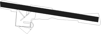
Runway info
| Runway 09 / 27 | ||
| length | 701m (2300ft) | |
| bearing | 99° / 279° | |
| width | 37m (120ft) | |
| surface | grass | |
| displ threshold | 41m (135ft) / 8m (26ft) | |
Nearby beacons
| code | identifier | dist | bearing | frequency |
|---|---|---|---|---|
| RIV | RIVOLTO TACAN | 12.6 | 256° | 110 |
| RON | RONCHI DEI LEGIONARI NDB | 14.3 | 183° | 396 |
| RCH | RONCHI DEI LEGIONARI VOR/DME | 15 | 156° | 114.20 |
| RIV | RIVOLTO NDB | 19.6 | 253° | 371 |
| AVI | AVIANO TACAN | 32.8 | 267° | 116.40 |
| PZ | PORTOROZ NDB | 36.9 | 158° | 388 |
| POR | PORTOROZ VOR/DME | 37 | 158° | 115.15 |
| AVI | AVIANO NDB | 40.3 | 261° | 390 |
| VIW | DME | 43.8 | 41° | 112.90 |
| ILB | BISTRICA VOR/DME | 45 | 122° | 114.80 |
| VRS | VRSAR NDB | 52.8 | 162° | 369 |
| BRZ | BREZA NDB | 56.2 | 124° | 400 |
Disclaimer
The information on this website is not for real aviation. Use this data with the X-Plane flight simulator only! Data taken with kind consent from X-Plane 12 source code and data files. Content is subject to change without notice.