Capena - Aviosuperficie Easy Flyte
Airport details
| Country | Italy |
| State | Lazio |
| Region | |
| Airspace | Rome Ctr |
| Municipality | Capena |
| Elevation | 120ft (37m) |
| Timezone | GMT +1 |
| Coordinates | 42.12650, 12.60891 |
| Magnetic var | |
| Type | land |
| ICAO code | XLI001K |
| IATA code | n/a |
| FAA code | n/a |
Communication
Nearby Points of Interest:
Modern Automata Museum
-Palazzo Giustiniani
-Museum Venanzo Crocetti
-Villa Madama
-Villa Giulia
-Biblioteca Nazionale Centrale di Roma
-Biblioteca medica statale Rome
-Biblioteca universitaria Alessandrina
-Santa Maria della Pietà psychiatric hospital
-Museum of the Baths of Diocletian
-Palazzo Leoni, Bologna
-Galleria d'arte moderna di Roma Capitale
-Palazzo Massimo alle Terme
-Giorgio De Chirico House
-Palazzo Barberini Mithraeum
-Palazzo del Tritone
-Capella dei Re Magi
-Istituto centrale per la grafica
-Palazzo Brancaccio
-Palazzo Firenze
-Palazzo della Consulta
-Palazzo Chigi
-Palazzo Cimarra
-Palazzo Casali
-Palazzo Koch
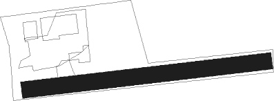
Runway info
| Runway 09 / 27 | ||
| length | 287m (942ft) | |
| bearing | 88° / 268° | |
| width | 20m (65ft) | |
| surface | grass | |
| blast zone | 14m (46ft) / 8m (26ft) | |
Nearby beacons
| code | identifier | dist | bearing | frequency |
|---|---|---|---|---|
| CMP | CAMPAGNANO VOR/DME | 10.1 | 269° | 111.40 |
| URB | URBE (ROME) NDB | 12.1 | 213° | 285 |
| ROM | ROME VOR/DME | 19.3 | 184° | 110.80 |
| OST | OSTIA NDB | 25.4 | 229° | 327 |
| OST | OSTIA VOR/DME | 25.5 | 229° | 114.90 |
| TPR | PRATICA DI MARE TACAN | 30.7 | 193° | 108.70 |
| VIB | VITERBO NDB | 30.9 | 300° | 480 |
| LAT | LATINA VOR/DME | 37.7 | 152° | 111.20 |
| TAQ | TARQUINIA VOR/DME | 39.3 | 276° | 111.80 |
| FRS | FROSINONE VOR/DME | 42.1 | 125° | 115.60 |
| PRU | PERUGIA NDB | 58.7 | 354° | 398 |
Disclaimer
The information on this website is not for real aviation. Use this data with the X-Plane flight simulator only! Data taken with kind consent from X-Plane 12 source code and data files. Content is subject to change without notice.