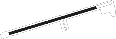
Podpec
Airport details
| Country | Slovenia |
| State | [Other] |
| Region | |
| Airspace | Ljubljana Ctr |
| Municipality | Brezovica |
| Elevation | 943ft (287m) |
| Timezone | GMT +1 |
| Coordinates | 45.97349, 14.41293 |
| Magnetic var | |
| Type | land |
| Available since | X-Plane v10.40 |
| ICAO code | XLJ0001 |
| IATA code | n/a |
| FAA code | n/a |
Communication
| Podpec AWOS | 123.500 |
Nearby Points of Interest:
Cerkev sv. Jožefa, Preserje
-Notranje Gorice railway halt
-St. Lawrence's Church
-Our Lady of Sorrows Church
-Cerkev svetega Tomaža, Planinca
-St. James's Church
-Brest Castle (Ebenporthen)
-Tomaž House
-Bistra Charterhouse
-hidroelektrarna Bistra
-Brest
-Matena
-Ig Castle
-Church of the Assumption of Mary
-Lavrenčič house
-Vič District
-Kunstle Villa
-Zaklanec
-Conversion of Paul the Apostle church
-Rožna Dolina
-Trnovo Bridge
-Krakovo Chapel
-Rome road
-Jek Bridge
-Zois road
Nearby beacons
| code | identifier | dist | bearing | frequency |
|---|---|---|---|---|
| MG | LJUBLJANA NDB | 13.3 | 36° | 296 |
| LBL | LJUBLJANA VOR/DME | 15.9 | 3° | 117.20 |
| DOL | DOLSKO VOR/DME | 16.6 | 73° | 112.70 |
| ILB | BISTRICA VOR/DME | 26.5 | 211° | 114.80 |
| BRZ | BREZA NDB | 33.1 | 187° | 400 |
| KFT | KLAGENFURT VOR/DME | 37.9 | 13° | 113.10 |
| KO | KOZALA (RIJEKA) NDB | 38.3 | 177° | 438 |
| KFT | KLAGENFURT NDB | 39.4 | 11° | 374 |
| KI | KLAGENFURT NDB | 39.6 | 357° | 313 |
| RCH | RONCHI DEI LEGIONARI VOR/DME | 39.9 | 261° | 114.20 |
| RK | CERKLJE-RAKA NDB | 41.1 | 94° | 359 |
| PZ | PORTOROZ NDB | 44.7 | 238° | 388 |
| POR | PORTOROZ VOR/DME | 44.9 | 238° | 115.15 |
| RJK | RIJEKA VOR/DME | 45.4 | 168° | 117.80 |
| VIW | DME | 48 | 325° | 112.90 |
| RI | RIJEKA (KRK ISLAND) NDB | 51.2 | 164° | 289 |
| KOR | DME | 54 | 34° | 109.40 |
| VRS | VRSAR NDB | 55.9 | 225° | 369 |
| TNJ | TOUNJ NDB | 58.7 | 128° | 316 |
Disclaimer
The information on this website is not for real aviation. Use this data with the X-Plane flight simulator only! Data taken with kind consent from X-Plane 12 source code and data files. Content is subject to change without notice.
