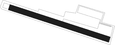
Kamnik - Kamnik-duplica
Airport details
| Country | Slovenia |
| State | [Other] |
| Region | |
| Airspace | Ljubljana Ctr |
| Municipality | Kamnik |
| Elevation | 1145ft (349m) |
| Timezone | GMT +1 |
| Coordinates | 46.19639, 14.58333 |
| Magnetic var | |
| Type | land |
| Available since | X-Plane v10.40 |
| ICAO code | XLJ000C |
| IATA code | n/a |
| FAA code | n/a |
Communication
| Kamnik-Duplica Kamnik Info | 123.500 |
Nearby beacons
| code | identifier | dist | bearing | frequency |
|---|---|---|---|---|
| MG | LJUBLJANA NDB | 1.7 | 230° | 296 |
| LBL | LJUBLJANA VOR/DME | 6.9 | 285° | 117.20 |
| DOL | DOLSKO VOR/DME | 10.5 | 120° | 112.70 |
| KFT | KLAGENFURT VOR/DME | 24.1 | 357° | 113.10 |
| KFT | KLAGENFURT NDB | 25.8 | 353° | 374 |
| KI | KLAGENFURT NDB | 27.5 | 335° | 313 |
| RK | CERKLJE-RAKA NDB | 38.1 | 110° | 359 |
| KOR | DME | 38.9 | 33° | 109.40 |
| VIW | DME | 40.8 | 307° | 112.90 |
| ILB | BISTRICA VOR/DME | 41.6 | 213° | 114.80 |
| CL | CERKLJE-HRASTJE NDB | 42 | 108° | 463 |
| COK | CERKLJE VOR/DME | 42.8 | 107° | 108.25 |
| BRZ | BREZA NDB | 47.4 | 197° | 400 |
| KO | KOZALA (RIJEKA) NDB | 52 | 189° | 438 |
| GRZ | GRAZ NDB | 56.5 | 50° | 290 |
| GRZ | GRAZ VOR/DME | 57.9 | 49° | 116.20 |
| RJK | RIJEKA VOR/DME | 58.3 | 181° | 117.80 |
| PZ | PORTOROZ NDB | 59.2 | 233° | 388 |
| POR | PORTOROZ VOR/DME | 59.4 | 233° | 115.15 |
| TNJ | TOUNJ NDB | 65.4 | 141° | 316 |
| VRS | VRSAR NDB | 71 | 223° | 369 |
Disclaimer
The information on this website is not for real aviation. Use this data with the X-Plane flight simulator only! Data taken with kind consent from X-Plane 12 source code and data files. Content is subject to change without notice.
