Airports for X-Plane offers a convenient way to explore airports and their related communication information for the X-Plane flight simulator. It only uses data from the X-Plane flight simulator itself, and is therefore more reliable than the data that comes from real aviation websites. You can search for airports by using the ICAO code, or browse for airports per country and state. The information displayed is categorized by airport details, runway information, airport communication, approach frequencies (ILS and Glidepath details), details of nearby beacons, SIDs, STARs and approach procedures.

seaplane railway station passenger airdrome taxiway aerodromes city takeoff field air safety ferry grass international non-towered airport consulate stol nearby luggage airliner capital

Campinho

Airport details

CountryPortugal
State[Other]
Region
AirspaceLisbon Ctr
MunicipalityReguengos de Monsaraz
Elevation628ft (191m)
TimezoneGMT +0
Coordinates38.36043, -7.46604
Magnetic var
Typeland
Available sinceX-Plane v11.40
ICAO codeXLP0054
IATA coden/a
FAA coden/a

Communication

No airport communication available for XLP0054
Nearby Points of Interest:
Castle of Lousa
-
Castle of Esporão
-
Igreja Paroquial de Monsaraz
-
Atalaia Magra
-
Igreja da Misericórdia
-
Vila Viçosa
-
Padrão de Montes Claros
-
Church of the Lóios
-
Castelo de Évora
-
Centro Histórico de Évora
-
Capela de Santa Luzia
-
Igreja de Nossa Senhora do Espinheiro
-
Igreja e Convento de Nossa Senhora dos Remédios
-
Porta de Avis (Évora)
-
Cerca medieval (Évora)
-
Arco romano de Dona Isabel
-
Pillory of Canal
-
Casa dos Arcos (Conceição)
-
Convento de São Bento de Cástris (Évora)
-
Santa Casa da Misericórdia de Olivença
-
Museu arqueológico e etnográfico de Barrancos
-
Chapel of Nossa Senhora dos Mártires
-
Cadeia Comarcã de Estremoz
-
Claustro da Misericórdia de Estremoz
-
pousada castelo de estremoz

Runway info

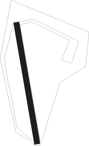
Runway 18 / 36
 length317m (1040ft)
 bearing173° / 353°
 width15m (49ft)
 surfacegrass

Airport layout


Nearby beacons

codeidentifierdistbearingfrequency
EVREVORA NDB22.4292°425
BEJBEJA TACAN25.8243°115.80
DMLRUIVA DME42204°114.50
TBCBADAJOZ TACAN4451°108.80
VBZBADAJOZ VOR/DME4451°116.80
DMTDME54.7315°110.80
DPRDME-ILS55.1188°111.50

Disclaimer

The information on this website is not for real aviation. Use this data with the X-Plane flight simulator only! Data taken with kind consent from X-Plane 12 source code and data files. Content is subject to change without notice.