Póvoa Do Varzim - São Miguel De Laúndos
Airport details
| Country | Portugal |
| State | [Other] |
| Region | |
| Airspace | Lisbon Ctr |
| Municipality | Póvoa de Varzim |
| Elevation | 262ft (80m) |
| Timezone | GMT +0 |
| Coordinates | 41.44875, -8.70943 |
| Magnetic var | |
| Type | land |
| Available since | X-Plane v11.50 |
| ICAO code | XLP0062 |
| IATA code | n/a |
| FAA code | n/a |
Communication
Nearby Points of Interest:
Igreja de São Cristóvão de Rio Mau
-Mosteiro de São Simão da Junqueira
-Lugar das Pedrinhas
-Póvoa de Varzim City Hall
-Necrópole Medieval de Fão
-Ponte metálica de Fão
-Passeio Alegre
-Penedo chamado a Laje dos Sinais
-Restos de uma construção conhecida pelo nome de Forno dos Mouros
-Igreja da Misericórdia de Esposende
-Solar de Fralães
-Ponte de Barcelos
-Torre da Porta Nova
-Campo da Feira de Barcelos
-Facho de Arvore
-Forte de Nossa Senhora da Assunção (Vila do Conde)
-Abelheira windmills
-Anta da Portelagem e Mamoas do Rápido
-Bom Jesus de Cambeses Sanctuary
-Igreja e Torre de Manhente
-Cruzeiro de Agrela
-Cruzeiro Paroquial de Aborim
-Aborim tower
-Igreja Paroquial de Aborim
-Igreja de Santiago de Antas
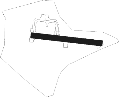
Runway info
| Runway 11 / 29 | ||
| length | 240m (787ft) | |
| bearing | 98° / 278° | |
| width | 20m (66ft) | |
| surface | asphalt | |
Nearby beacons
| code | identifier | dist | bearing | frequency |
|---|---|---|---|---|
| PRT | PORTO VOR/DME | 10.5 | 173° | 114.10 |
| DSA | DME | 21 | 360° | 115.20 |
| DMU | DME | 31.7 | 55° | 113.80 |
| OVR | OVAR TACAN | 33.8 | 173° | 110.60 |
| DAR | DME | 37.9 | 137° | 114.90 |
| DMR | DME | 39 | 104° | 114.60 |
| VON | VIGO NDB | 44.3 | 5° | 433 |
| VI | VIGO NORTH NDB | 52.4 | 7° | 345 |
| VGO | VIGO VOR/DME | 52.6 | 7° | 113.60 |
| VIS | VISEU VOR/DME | 57.3 | 131° | 113.10 |
Disclaimer
The information on this website is not for real aviation. Use this data with the X-Plane flight simulator only! Data taken with kind consent from X-Plane 12 source code and data files. Content is subject to change without notice.