Agueda - Casarao
Airport details
| Country | Portugal |
| State | [Other] |
| Region | |
| Airspace | Lisbon Ctr |
| Municipality | Águeda |
| Elevation | 305ft (93m) |
| Timezone | GMT +0 |
| Coordinates | 40.54712, -8.40443 |
| Magnetic var | |
| Type | land |
| Available since | X-Plane v10.40 |
| ICAO code | XLP0076 |
| IATA code | n/a |
| FAA code | n/a |
Communication
Nearby Points of Interest:
Ponte do Cabeço do Vouga
-Complexo Termal do Luso
-Buçaco Forest
-Ponte Pedonal sobre o Esteiro de São Pedro
-Mosteiro de Jesus, compreendendo o túmulo de Santa Joana
-Cine-Teatro Avenida
-Casa do Seixal
-Church of São João Evangelista (Aveiro)
-Edifício das Obras Públicas de Aveiro
-Edifício «Arte Nova»
-Edifício Arte Nova, também denominado «Casa do Major Pessoa»
-Casa Gafanhoa
-Castro de Nandufe
-Quinta da Caneira
-Igreja Matriz de Treixedo
-Capela de Nossa Senhora dos Navegantes
-Forte da Barra Lighthouse
-Convento de São Cristóvão de Lafões
-Ançã
-Ponte de Coronados
-Ponte de Cavalos
-Solar dos Malafaias (Serrazes)
-Solar de Beirós
-Igreja Matriz de São João de Areias
-Termas Romanas de São Pedro do Sul
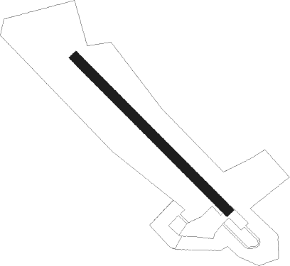
Runway info
| Runway 14 / 32 | ||
| length | 551m (1808ft) | |
| bearing | 132° / 312° | |
| width | 25m (82ft) | |
| surface | asphalt | |
| displ threshold | 0m (0ft) / 42m (138ft) | |
| blast zone | 19m (62ft) / 0m (0ft) | |
Nearby beacons
| code | identifier | dist | bearing | frequency |
|---|---|---|---|---|
| OVR | OVAR TACAN | 23.1 | 325° | 110.60 |
| DAR | DME | 24.5 | 25° | 114.90 |
| VIS | VISEU VOR/DME | 25.8 | 71° | 113.10 |
| PRT | PORTO VOR/DME | 45.4 | 339° | 114.10 |
| DMR | DME | 48.2 | 36° | 114.60 |
| MTR | MONTE REAL TACAN | 48.3 | 214° | 109.60 |
| FTM | FATIMA VOR/DME | 53 | 186° | 113.50 |
| NSA | NISA VOR/DME | 63.1 | 154° | 115.50 |
Disclaimer
The information on this website is not for real aviation. Use this data with the X-Plane flight simulator only! Data taken with kind consent from X-Plane 12 source code and data files. Content is subject to change without notice.