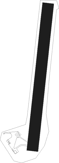
Zaluzani - Banja Luka/zaluzani
Airport details
| Country | Bosnia and Herzegovina |
| State | Republika Srpska |
| Region | LQ |
| Airspace | Sarajevo Ctr |
| Municipality | Banja Luka |
| Elevation | 460ft (140m) |
| Timezone | GMT +1 |
| Coordinates | 44.84493, 17.22035 |
| Magnetic var | |
| Type | land |
| ICAO code | XLQ0003 |
| IATA code | n/a |
| FAA code | n/a |
Communication
| Banja Luka/Zaluzani Zaluzani Info | 123.500 |
Nearby Points of Interest:
Hadži Kurd džamija
-église de la Visitation-de-la-Vierge-Marie de Banja Luka
-Stupnička džamija
-Jama džamija
-Hacı Ömer Mosque, Banja Luka
-Šeranić house
-Talih džamija
-Grabska džamija
-Sokolski dom in Banja Luka
-Potpećinska džamija
-Potok mosque
-Mehdi-bey Imamović mosque
-Hadži Zulfikar mosque
-église de l'Ascension de Kola
-Old St. Nicholas Church, Javorani
-Gomionica Monastery
-église Saint-Nicolas de Krupa na Vrbasu
-église Saint-Pierre-et-Saint-Paul de Kozarac
-St. Nicholas Church in Živinice
-Stećak à Baljvine
-Holy Trinity church in Prijedor
-Hamzibeys mosque
-Hamidija džamija
-Ključ na Sani
Nearby beacons
| code | identifier | dist | bearing | frequency |
|---|---|---|---|---|
| NA | BANJA LUKA NDB | 5.8 | 47° | 383 |
| LAK | BANJA LUKA VOR/DME | 6.6 | 38° | 115.30 |
| LU | BANJA LUKA NDB | 7.6 | 32° | 397 |
| BLK | BANJA LUKA NDB | 15.1 | 9° | 340 |
| OMA | OMARSKA VOR/DME | 18.9 | 285° | 117.90 |
| DER | DERVENTA VOR/DME | 32.9 | 79° | 112.40 |
| KOS | KOSTAJNICA NDB | 37 | 300° | 316 |
| VBA | BARNA VOR/DME | 54.3 | 355° | 117.40 |
| KIS | SARAJEVO VOR/DME | 61.4 | 134° | 116 |
| VRL | VRLIKA NDB | 64.3 | 221° | 283 |
| KG | KOBILJACA (SARAJEVO) NDB | 70.9 | 135° | 357 |
Disclaimer
The information on this website is not for real aviation. Use this data with the X-Plane flight simulator only! Data taken with kind consent from X-Plane 12 source code and data files. Content is subject to change without notice.
