Visoko
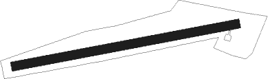
Airport details
| Country | Bosnia and Herzegovina |
| State | Federation of Bosnia and Herzegovina |
| Region | LQ |
| Airspace | Sarajevo Ctr |
| Municipality | Grad Visoko |
| Elevation | 1470ft (448m) |
| Timezone | GMT +1 |
| Coordinates | 44.02500, 18.09694 |
| Magnetic var | |
| Type | land |
| Available since | X-Plane v10.40 |
| ICAO code | XLQ0005 |
| IATA code | n/a |
| FAA code | n/a |
Communication
| Visoko Visoko Info | 123.500 |
Nearby Points of Interest:
Franciscan monastery in Visoko
-Franciscan monastery in Kraljeva Sutjeska
-Kreševo Franciscan Convent
-église Saint-Élie de Zenica
-vieille église Saint-Michel de Vareš
-Church of the Nativity of Our Lady, Zenica
-Donji Močioci necropolis
-Objects of the warehouse in the area of former industrial zone in Sarajevo
-Officers' Pavilions, the architectural ensemble
-Building of the Railway Savings Cooperative in Sarajevo
-Marijin dvor
-Red Cross building in Sarajevo
-Residential complex on Džidžikovac, the architectural ensemble
-Pension Fund building
-Vraca Memorial Park
-Building of the Presidency of Bosnia and Herzegovina
-Railways Building in Sarajevo
-Building of the Rijaset of the Islamic Community of Bosnia and Herzegovina and Vakuf Directorate
-Damić house
-Musafija Palace
-Missie’s House
-Salom’s Palace
-Sarajevo fire brigade barracks
-Napredak building
-Central Post Office in Sarajevo
Nearby beacons
| code | identifier | dist | bearing | frequency |
|---|---|---|---|---|
| KIS | SARAJEVO VOR/DME | 1.5 | 259° | 116 |
| KG | KOBILJACA (SARAJEVO) NDB | 9.2 | 151° | 357 |
| AS | SARAJEVO NDB | 14.7 | 132° | 381 |
| IL | SARAJEVO NDB | 15.8 | 130° | 405 |
| KEB | SARAJEVO VOR/DME | 16.2 | 104° | 116.70 |
| SAR | SARAJEVO NDB | 16.4 | 104° | 375 |
| TU | TUZLA NDB | 31.8 | 40° | 445 |
| ZV | ZIVINICE NDB | 35.5 | 51° | 402 |
| TZU | TUZLA VOR/DME | 37.7 | 56° | 108.80 |
| MSR | MOSTAR VOR/DME | 47 | 198° | 116.90 |
| MA | MOSTAR NDB | 49.5 | 197° | 355 |
| DNC | MOSTAR NDB | 54.3 | 196° | 425 |
| GAC | GACKO NDB | 56.6 | 152° | 370 |
| DER | DERVENTA VOR/DME | 57.8 | 352° | 112.40 |
| NA | BANJA LUKA NDB | 63.7 | 318° | 383 |
| LAK | BANJA LUKA VOR/DME | 64.8 | 319° | 115.30 |
| LU | BANJA LUKA NDB | 65.9 | 319° | 397 |
Disclaimer
The information on this website is not for real aviation. Use this data with the X-Plane flight simulator only! Data taken with kind consent from X-Plane 12 source code and data files. Content is subject to change without notice.