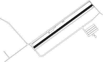
Bistrita - Bistrita Aerodrom
Airport details
| Country | Romania |
| State | BISTRITA-NASAUD |
| Region | |
| Airspace | Bucharest Ctr |
| Municipality | Bistrița |
| Elevation | 1299ft (396m) |
| Timezone | GMT +2 |
| Coordinates | 47.15855, 24.55231 |
| Magnetic var | |
| Type | land |
| Available since | X-Plane v10.40 |
| ICAO code | XLRBIST |
| IATA code | n/a |
| FAA code | n/a |
Communication
| BISTRITA AERODROM ATC | 123.450 |
Nearby Points of Interest:
Synagogue of Bistrița
-Minorit Church in Bistriţa
-Centrul Municipal pentru Cultură George Coșbuc
-Sugălete Passage in Bistriţa
-Biserica Evanghelică din Bistrița
-Cazinoul Bistrița
-Church of the Dormition in Budacu de Jos
-Ansamblul bisericii evanghelice C.A. din Dumitra
-Lutheran church in Herina, Bistrița-Năsăud
-Dormition of the Mother of God Church in Albeștii Bistriței
-Archangels church in Corvinești, Bistrița-Năsăud
-Wooden church in Sângeorzu Nou
-Bethlen Pal Castle in Beclean
-Wooden church in Bungard, Bistrița-Năsăud
-Wooden church in Strugureni, Bistrița-Năsăud
-Reformed church in Comlod, Bistrița-Năsăud
-Wooden church in Comlod, Bistrița-Năsăud
-Wooden church in Năsal, Cluj
-Wooden church in Lacu
-Roman-Catholic church in Cătina, Cluj
-Wooden church in Silivașu de Câmpie
-Wooden church in Bonț
Runway info
| Runway 05 / 23 | ||
| length | 831m (2726ft) | |
| bearing | 67° / 247° | |
| width | 20m (66ft) | |
| surface | grass | |
| displ threshold | 25m (82ft) / 25m (82ft) | |
Nearby beacons
| code | identifier | dist | bearing | frequency |
|---|---|---|---|---|
| HNU | HENIU TACAN | 10.3 | 57° | 133.60 |
| CLJ | CLUJ NAPOCA VOR/DME | 38 | 245° | 111.20 |
| D | TARGU MURES NDB | 42.4 | 194° | 373 |
| TGM | TARGU MURES NDB | 43.9 | 199° | 428 |
| CHU | CIUHII DME | 59.6 | 165° | 109.20 |
Disclaimer
The information on this website is not for real aviation. Use this data with the X-Plane flight simulator only! Data taken with kind consent from X-Plane 12 source code and data files. Content is subject to change without notice.
