Timisoara - Cioca Utilitar Timisoara
Airport details
| Country | Romania |
| State | TIMIS |
| Region | |
| Airspace | Bucharest Ctr |
| Municipality | Timișoara |
| Elevation | 279ft (85m) |
| Timezone | GMT +2 |
| Coordinates | 45.78698, 21.19018 |
| Magnetic var | |
| Type | land |
| Available since | X-Plane v11.10 |
| ICAO code | XLRCIOC |
| IATA code | n/a |
| FAA code | n/a |
Communication
| CIOCA UTILITAR TIMISOARA ATC | 128.900 |
Nearby Points of Interest:
Serbian St. Nicholas Church, Mehala
-Spitalul Militar din Timișoara
-Spitalul Mizericordienilor din Timișoara
-Claustrul mănăstirii Franciscanilor din Timișoara
-Urban ensemble VII, Timișoara
-Military Casino of Timișoara
-Nedelkovich House in Timișoara
-Urban ensemble "Str. Anton Seiller"
-Old City Hall of Timișoara
-Virgin Mary & St John of Nepomuk Monument in Timișoara
-Piarist High School, Timișoara
-House with Atlantes, Timișoara
-Timișoara Fortress
-Urban site the Neighborhood "Timisoara Fortress"
-Urban ensemble "Splaiul Nicolae Titulescu"
-Palace of Culture in Timisoara
-Cigarette factory, Timișoara
-Gemeinhardt Palace, Timișoara
-Dicasterial Palace, Timișoara
-Deschan Palace in Timișoara
-Palace with Anchor
-Capitoline Wolf in Timișoara
-Interwar urban ensemble "Corso" in Timişoara
-Count of Mercy House, Timișoara
-Former Hotel Royal
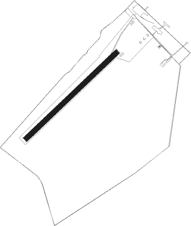
Runway info
| Runway 05 / 23 | ||
| length | 701m (2300ft) | |
| bearing | 60° / 240° | |
| width | 30m (98ft) | |
| surface | grass | |
Nearby beacons
| code | identifier | dist | bearing | frequency |
|---|---|---|---|---|
| TA | TIMISOARA NDB | 3.4 | 40° | 378 |
| TSR | TRAIAN VUIA (TIMISOARA) NDB | 5.1 | 75° | 408 |
| TIM | TRAIAN VUIA (TIMISOARA) NDB | 7.6 | 85° | 338 |
| CNI | DME | 12.5 | 256° | 115.60 |
| ARD | ARAD NDB | 23.9 | 353° | 517 |
| LGJ | LUGOJ TACAN | 33.9 | 95° | 134 |
| VAC | VRSAC VOR/DME | 39.2 | 170° | 115 |
| VRA | VRSAC NDB | 42.2 | 172° | 294 |
| BC | BEKESCSABA NDB | 52.7 | 358° | 400 |
| PA | PANCEVO (BELGRADE) NDB | 58.5 | 212° | 495 |
| PZ | BATAJNICA (BELGRADE) NDB | 64.5 | 229° | 320 |
| BT | BATAJNICA (BELGRADE) NDB | 64.6 | 231° | 420 |
| EK | BATAJNICA (BELGRADE) NDB | 64.6 | 225° | 420 |
| BGD | BELGRADE VOR/DME | 68.9 | 222° | 112.05 |
Disclaimer
The information on this website is not for real aviation. Use this data with the X-Plane flight simulator only! Data taken with kind consent from X-Plane 12 source code and data files. Content is subject to change without notice.