Sirna - Sirna Tecnam
Airport details
| Country | Romania |
| State | PRAHOVA |
| Region | |
| Airspace | Bucharest Ctr |
| Municipality | Șirna |
| Elevation | 390ft (119m) |
| Timezone | GMT +2 |
| Coordinates | 44.78400, 25.98300 |
| Magnetic var | |
| Type | land |
| Available since | X-Plane v10.40 |
| ICAO code | XLRSIRN |
| IATA code | n/a |
| FAA code | n/a |
Communication
| SIRNA TECNAM ATC | 123.450 |
Nearby Points of Interest:
Biserica „Sf. Nicolae” din Ghermănești
-Biserica „Adormirea Maicii Domnului” din Dascălu
-Biserica de lemn din Gagu
-Mănăstirea Sitaru
-Biserica Galbenă „Sf. Dimitrie”, „Sf. Nicolae”
-Mansion of Matei and Toma Cantacuzino in Filipeștii de Pădure
-Biserica „Sf. Împărați Constantin și Elena” din Vânători
-Biserica „Sf. Nicolae” din Ștefăneștii de Sus
-Wooden church in Luieriu
-Aurel Vlaicu International Airport
-Biserica „Adormirea Maicii Domnului” din Petrăchioaia
-Herăstrău Park
-Biserica „Schimbarea la Față” din Moreni
-Monument to Nicolae Iorga, Ion Irimescu
-Statuile „Muncitori” din București
-Embassy of Poland, Bucharest
-Manu-Auschnitt House
-Victoria Palace
-Admiral Vasile Urseanu House, Bucharest
-George Severeanu Museum
-Macca House, Bucharest
-Matache Măcelaru Hall
-Capitoline Wolf in Bucharest
-Muzeul Literaturii Române
-Romanian Academy Library
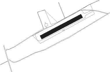
Runway info
| Runway 09 / 27 | ||
| length | 501m (1644ft) | |
| bearing | 73° / 253° | |
| width | 45m (148ft) | |
| surface | grass | |
Nearby beacons
| code | identifier | dist | bearing | frequency |
|---|---|---|---|---|
| STJ | STREJNIC VOR/DME | 8 | 357° | 113.20 |
| OTL | OTOPENI (BUCHAREST) NDB | 12.8 | 175° | 370 |
| LL | OTOPENI (BUCHAREST) NDB | 13 | 157° | 659 |
| OPW | OTOPENI (BUCHAREST) NDB | 13.5 | 180° | 267 |
| OPE | OTOPENI (BUCHAREST) NDB | 15.9 | 133° | 349 |
| OTR | OTOPENI (BUCHAREST) NDB | 15.9 | 128° | 318 |
| BSE | BANEASA (BUCHAREST) NDB | 18.5 | 136° | 256 |
| BSW | BANEASA (BUCHAREST) NDB | 18.7 | 186° | 521 |
| FLR | FLORESTI VOR/DME | 20.6 | 224° | 112.20 |
| OPT | ROSIORI VOR/DME | 27.1 | 108° | 117.10 |
| BRV | BRASOV VOR/DME | 50.2 | 332° | 117.60 |
Disclaimer
The information on this website is not for real aviation. Use this data with the X-Plane flight simulator only! Data taken with kind consent from X-Plane 12 source code and data files. Content is subject to change without notice.