Malārd - Karaj/fath
Airport details
| Country | Iran |
| State | [Other] |
| Region | |
| Airspace | Tehran Ctr |
| Municipality | Malard-e Shomali RD |
| Elevation | 3999ft (1219m) |
| Timezone | GMT +3.5 |
| Coordinates | 35.71412, 50.93365 |
| Magnetic var | |
| Type | land |
| Available since | X-Plane v10.40 |
| ICAO code | XOI0001 |
| IATA code | n/a |
| FAA code | n/a |
Communication
Nearby Points of Interest:
Mehrshahr Apple Garden
-Tepe Balkin
-Pol-e Dokhtar (Karaj)
-Tepe Juqin
-Baba Mahmud Tower
-Imamzadeh Hazratein
-Imamzadeh Husayn (Kordan)
-Imamzadeh Zeid and Rahman
-Bazarak Bridge
-Robat Karim Watermill
-Torsh Anbeh Icehouse
-Tepe Mafinabad
-Tepe Nezamabad (Eslamshahr County)
-Sain Minas church
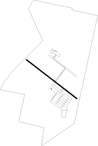
Runway info
| Runway 13R / 31L | ||
| length | 1298m (4259ft) | |
| bearing | 126° / 306° | |
| width | 25m (82ft) | |
| surface | asphalt | |
| displ threshold | 131m (430ft) / 155m (509ft) | |
Nearby beacons
| code | identifier | dist | bearing | frequency |
|---|---|---|---|---|
| PIM | PAYAM VOR/DME | 4.9 | 300° | 117.50 |
| PIM | PAYAM NDB | 5 | 300° | 306 |
| RUS | RUDESHUR VOR/DME | 16.1 | 186° | 116.95 |
| THR | TEHRAN TACAN | 16.9 | 93° | 113.30 |
| TRN | TEHRAN VOR/DME | 17.1 | 93° | 115.30 |
| IKA | IMAM KHOMAINI VOR/DME | 21.8 | 141° | 114.30 |
| IKA | IMAM KHOMAINI NDB | 22.1 | 141° | 201 |
| KAZ | KAHRIZAK NDB | 24.2 | 114° | 358 |
| VR | VARAMIN NDB | 40.9 | 118° | 373 |
| SAV | SAVEH NDB | 50 | 219° | 408 |
| NSR | NOSHAHR NDB | 62.4 | 29° | 260 |
Disclaimer
The information on this website is not for real aviation. Use this data with the X-Plane flight simulator only! Data taken with kind consent from X-Plane 12 source code and data files. Content is subject to change without notice.