Sas Al Nakhl
Airport details
| Country | United Arab Emirates |
| State | Abu Dhabi Emirate |
| Region | |
| Airspace | Emirates Ctr |
| Municipality | Sas Al Nakhl |
| Elevation | 5ft (2m) |
| Timezone | GMT +4 |
| Coordinates | 24.44894, 54.51408 |
| Magnetic var | |
| Type | land |
| Available since | X-Plane v11.00 |
| ICAO code | XOMNK |
| IATA code | n/a |
| FAA code | n/a |
Communication
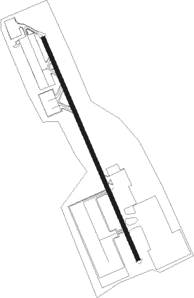
Runway info
| Runway 16 / 34 | ||
| length | 1916m (6286ft) | |
| bearing | 160° / 340° | |
| width | 30m (98ft) | |
| surface | asphalt | |
| blast zone | 49m (161ft) / 40m (131ft) | |
Nearby beacons
| code | identifier | dist | bearing | frequency |
|---|---|---|---|---|
| ALB | AL BATEEN (ABU DHABI) VOR/DME | 3.7 | 261° | 114 |
| ADV | ABU DHABI VOR/DME | 8.8 | 101° | 114.25 |
| MIN | MINHAD VOR/DME | 59.2 | 57° | 115.20 |
Disclaimer
The information on this website is not for real aviation. Use this data with the X-Plane flight simulator only! Data taken with kind consent from X-Plane 12 source code and data files. Content is subject to change without notice.