Sohar - Suhar Intl
Airport details
| Country | Oman |
| State | Al Batinah North Governorate |
| Region | OO |
| Airspace | Muscat Ctr |
| Municipality | Sohar |
| Elevation | 144ft (44m) |
| Timezone | GMT +4 |
| Coordinates | 24.38611, 56.62562 |
| Magnetic var | |
| Type | land |
| Available since | X-Plane v10.40 |
| ICAO code | XOO0003 |
| IATA code | OHS |
| FAA code | n/a |
Communication
| Suhar Intl Sohar Information | 118.725 |
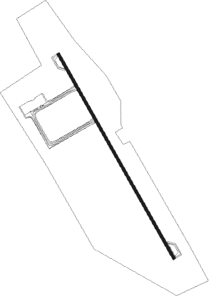
Runway info
| Runway 15 / 33 | ||
| length | 4014m (13169ft) | |
| bearing | 153° / 333° | |
| width | 52m (170ft) | |
| surface | asphalt | |
| blast zone | 121m (397ft) / 121m (397ft) | |
Nearby beacons
| code | identifier | dist | bearing | frequency |
|---|---|---|---|---|
| FJV | FUJAIRAH VOR/DME | 45.3 | 339° | 113.80 |
Disclaimer
The information on this website is not for real aviation. Use this data with the X-Plane flight simulator only! Data taken with kind consent from X-Plane 12 source code and data files. Content is subject to change without notice.