Matagorda Island - Aransas Natl Wildlife Refuge
Airport details
| Country | United States of America |
| State | Texas |
| Region | |
| Airspace | Houston Oceanic Ctr |
| Municipality | Calhoun County |
| Elevation | 7ft (2m) |
| Timezone | GMT -6 |
| Coordinates | 28.12909, -96.80028 |
| Magnetic var | |
| Type | land |
| Available since | X-Plane v10.32 |
| ICAO code | XS10 |
| IATA code | n/a |
| FAA code | XS10 |
Communication
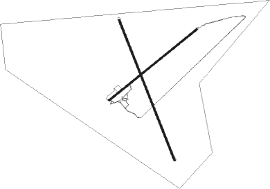
Runway info
Runway 16 / 34  | ||
| length | 1366m (4482ft) | |
| bearing | 161° / 341° | |
| width | 15m (50ft) | |
| surface | asphalt | |
| Runway 5 / 23 | ||
| length | 1027m (3369ft) | |
| bearing | 59° / 239° | |
| width | 15m (50ft) | |
| surface | asphalt | |
Nearby beacons
| code | identifier | dist | bearing | frequency |
|---|---|---|---|---|
| CRP | CORPUS CHRISTI VORTAC | 36.7 | 251° | 115.50 |
| NGP | TRUAX (CORPUS CHRISTI) TACAN | 37.3 | 228° | 114 |
| PSX | PALACIOS VORTAC | 46.2 | 38° | 117.30 |
| VCT | VICTORIA VOR/DME | 47.2 | 347° | 109 |
Disclaimer
The information on this website is not for real aviation. Use this data with the X-Plane flight simulator only! Data taken with kind consent from X-Plane 12 source code and data files. Content is subject to change without notice.