Airports for X-Plane offers a convenient way to explore airports and their related communication information for the X-Plane flight simulator. It only uses data from the X-Plane flight simulator itself, and is therefore more reliable than the data that comes from real aviation websites. You can search for airports by using the ICAO code, or browse for airports per country and state. The information displayed is categorized by airport details, runway information, airport communication, approach frequencies (ILS and Glidepath details), details of nearby beacons, SIDs, STARs and approach procedures.

immigration runway lighting consulate tarmac military metro warfare commuter air traffic control plane asphalt helipad road flights airports airfield hotel airport runway transit

Strathallan

Airport details

CountryUnited Kingdom
StateScotland
Region
AirspaceScottish Ctr
MunicipalityPerth and Kinross
Elevation120ft (37m)
TimezoneGMT +0
Coordinates56.32522, -3.74681
Magnetic var
Typeland
Available sinceX-Plane v10.40
ICAO codeXSTR
IATA coden/a
FAA coden/a

Communication

Strathallan Strathallan Radio129.900
Nearby Points of Interest:
Innerpeffray Collegiate Church of the Blessed Virgin
-
Crieff, 30, 32, 34, 36, 38, 40 High Street
-
Fowlis Wester, Cross
-
Crieff, Comrie Street, South United Free Church
-
Castle Cluggy
-
Ochtertyre House
-
Forteviot Square
-
Forteviot Village Hall
-
Lawers House
-
Glenalmond College
-
Methven Parish Church and churchyard
-
Comrie, 1 Dunira Street
-
Comrie, Dunira Street, Old Parish Church
-
Kinbuck Bridge
-
Aberuchill Castle
-
Tillicoultry, Ochil Street, Town Hall
-
Alva Churchyard, Johnstone Mausoleum
-
Drummonie House
-
Leighton Library
-
King James VI Hospital
-
Battleby
-
Perth, King Edward Street, City Hall
-
Perth, Rose Terrace, Old Perth Academy
-
Perth, Tay Street, Waterworks
-
2–8 Atholl Crescent, Perth

Runway info

Runway 10 / 28
 length659m (2162ft)
 bearing92° / 272°
 width14m (46ft)
 surfacegrass

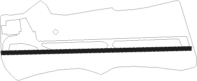
Airport layout


Nearby beacons

codeidentifierdistbearingfrequency
PTHPERTH VOR14.473°110.40
DNDDUNDEE NDB22.478°394
EDNEDINBURGH NDB25.9127°341
UWEDINBURGH NDB26.5150°368
LUKLEUCHARS TACAN29.587°110.50
GLWGLASGOW NDB35.7236°331
GOWGLASGOW VOR/DME35.9237°115.40
TLATALLA VOR/DME51.3155°113.80
DUDDME54.2228°115.45
GLOLOWTHER DME56.1179°109.65
PIKPRESTWICK NDB56.5225°355

Disclaimer

The information on this website is not for real aviation. Use this data with the X-Plane flight simulator only! Data taken with kind consent from X-Plane 12 source code and data files. Content is subject to change without notice.