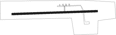
Enem - Afipskiy (svobodniy)
Airport details
| Country | Russian Federation |
| State | Krasnodar Krai |
| Region | |
| Airspace | Rostov-na-donu Ctr |
| Municipality | Смоленское сельское поселение |
| Elevation | 48ft (15m) |
| Timezone | GMT +3 |
| Coordinates | 44.85458, 38.81785 |
| Magnetic var | |
| Type | land |
| Available since | X-Plane v10.30 |
| ICAO code | XU000B |
| IATA code | n/a |
| FAA code | n/a |
Communication
Nearby beacons
| code | identifier | dist | bearing | frequency |
|---|---|---|---|---|
| SM | SMOLENSKAYA NDB | 4.8 | 192° | 662 |
| KR | PASHKOVSKIY (KRASNODAR) NDB | 17.6 | 64° | 377 |
| KND | KRASNODAR VOR/DME | 17.7 | 64° | 115.80 |
| XT | RYAZANSKAYA NDB | 32.9 | 82° | 312 |
| DV | DZHUBGA NDB | 33 | 192° | 420 |
| GN | GELENDZHIK NDB | 38.1 | 251° | |
| GNV | GELENDZHIK VOR/DME | 38.3 | 251° | 114.30 |
| NZ | UST-LABINSK NDB | 42.3 | 67° | 330 |
| AG | AGOY NDB | 43.8 | 164° | 381 |
| AGO | DME | 43.8 | 164° | 116.80 |
| LA | LAZAREVSKOYE NDB | 60.9 | 151° | 307 |
| LAZ | DME | 60.9 | 151° | 117.40 |
Disclaimer
The information on this website is not for real aviation. Use this data with the X-Plane flight simulator only! Data taken with kind consent from X-Plane 12 source code and data files. Content is subject to change without notice.