Yaroslavl - Karachikha
Airport details
| Country | Russian Federation |
| State | Yaroslavl Oblast |
| Region | |
| Airspace | Moscow Ctr |
| Municipality | Ивняковское сельское поселение |
| Elevation | 328ft (100m) |
| Timezone | GMT +3 |
| Coordinates | 57.65377, 39.76105 |
| Magnetic var | |
| Type | land |
| Available since | X-Plane v10.40 |
| ICAO code | XUDA |
| IATA code | n/a |
| FAA code | n/a |
Communication
| Karachikha Start | 135.000 |
Nearby Points of Interest:
Butusov District
-Maksim Bahdanovich Museum, Yaroslavl
-Charyshnikov House
-Petropavlovsky Park
-Trading Arcades, Yaroslavl
-historical centre of Yaroslavl
-Yaroslavl Art Institute
-Pavilions on Volzhskaya embankment in Yaroslavl
-Governor's Palace in Yaroslavl
-Monument to the Fighters for Soviet Power
-Yaroslavl Higher Military Air Defence School
-Demidovsky Garden Square
-Eternal flame in Yaroslavl
-Volzhskie Vorota Bridge
-Church of the Nativity of Christ, Ponomaryovo
-Kazan Church (Petropavlovskoye-on-Bykov mountains)
-Church of the Holy Mandylion (Nikolo-Zabolotye)
-Velikoselsky Kremiln
-Holy Trinity church
-Holy Mandylion church
-Church of Saint Sergius of Radonezh, Tatishchev Pogost
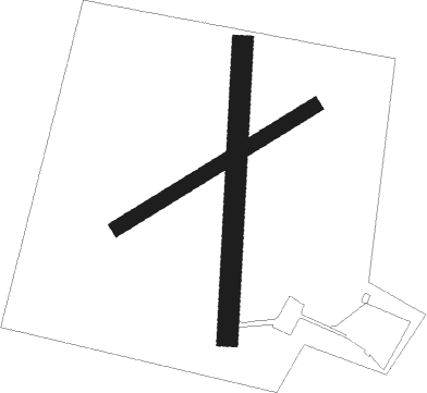
Runway info
Runway 18 / 36  | ||
| length | 700m (2297ft) | |
| bearing | 194° / 14° | |
| width | 50m (164ft) | |
| surface | dirt | |
| Runway 05 / 23 | ||
| length | 552m (1811ft) | |
| bearing | 75° / 255° | |
| width | 35m (115ft) | |
| surface | dirt | |
Nearby beacons
| code | identifier | dist | bearing | frequency |
|---|---|---|---|---|
| KA | (YAROSLAVL) DME | 14.3 | 102° | 109.40 |
| R | TUNOSHNA (YAROSLAVL) NDB | 14.7 | 101° | 650 |
| RG | TUNOSHNA (YAROSLAVL) NDB | 15.9 | 99° | 315 |
Disclaimer
The information on this website is not for real aviation. Use this data with the X-Plane flight simulator only! Data taken with kind consent from X-Plane 12 source code and data files. Content is subject to change without notice.