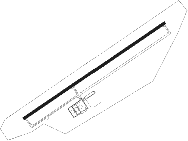
Airports for X-Plane offers a convenient way to explore airports and their related communication information for the X-Plane flight simulator. It only uses data from the X-Plane flight simulator itself, and is therefore more reliable than the data that comes from real aviation websites. You can search for airports by using the ICAO code, or browse for airports per country and state. The information displayed is categorized by airport details, runway information, airport communication, approach frequencies (ILS and Glidepath details), details of nearby beacons, SIDs, STARs and approach procedures.

helicopters passengers road flight aviation local government taxiway airports automated airport weather station seaplanes passenger flight attendant heliport propeller plane stol capital station near airplane public transport

Orsha

Airport details

CountryBelarus
StateVitsebsk Region
RegionUM
AirspaceMinsk Ctr
MunicipalityБалбасава
Elevation658ft (201m)
TimezoneGMT +3
Coordinates54.43766, 30.28970
Magnetic var
Typeland
Available sinceX-Plane v10.40
ICAO codeXUM0003
IATA coden/a
FAA coden/a

Communication

No airport communication available for XUM0003
Nearby Points of Interest:
Monument of Konstantin Zaslonov in Orša
-
Franciscan Monastery in Orša
-
Church of Saint Ilya in Orša
-
Catholic church of Saint Joseph in Orša
-
Orša Castle
-
Minskaja Street 11, Orša
-
Minskaja Street 17, Orša
-
Jesuit Collegium in Orsha
-
Residential Building of Basilian Monastery in Orša
-
Lienina street 11, Orša
-
Residential Building of Bernardinian Monastery in Orša
-
Memorial Complex «Katyusha» in Orsha
-
Former Cloister of Trinitarian in Orša
-
Lienina street 26, Orša
-
Lienina street 41, Orša
-
Church of Saints Peter and Paul in Brazdziečyna
-
Church of Saint Alex in Smaliany
-
Church of Saint Virgin Mary in Smaliany
-
Category:Church St. Ilya in Vysokaje (Orša District)
-
Church of the Holy Trinity in Arechaŭsk
-
Saint George Orthodox church in Staroje Vysokaje
-
Church of Saint Anthony in Talačyn

Runway info

Runway 05 / 23
 length3004m (9856ft)
 bearing72° / 252°
 width45m (148ft)
 surfaceconcrete

Airport layout


Taxiway locations
Parking locations

Nearby beacons

codeidentifierdistbearingfrequency
ORSORSHA VOR/DME1.972°110.40
UMAHILIOU NDB29205°985
MGLMAHILIOU VOR/DME29.9202°116.75
CMAHILIOU NDB30.4199°985
WVICIEBSK NDB40.710.650
VTBVICIEBSK VOR/DME41.5112.70
UVICIEBSK NDB4210.650

Disclaimer

The information on this website is not for real aviation. Use this data with the X-Plane flight simulator only! Data taken with kind consent from X-Plane 12 source code and data files. Content is subject to change without notice.