Mengkendek - Toraja
Airport details
| Country | Indonesia |
| State | South Sulawesi |
| Region | |
| Airspace | Ujung Pandang Ctr |
| Municipality | Tana Toraja Regency |
| Elevation | 3023ft (921m) |
| Timezone | GMT +8 |
| Coordinates | -3.18600, 119.91800 |
| Magnetic var | |
| Type | land |
| Available since | X-Plane v10.40 |
| ICAO code | XWI0009 |
| IATA code | TRT |
| FAA code | n/a |
Communication
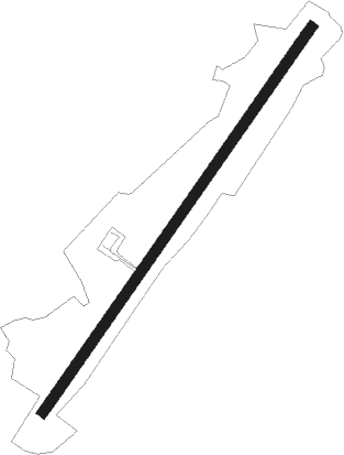
Runway info
| Runway 03 / 21 | ||
| length | 2011m (6598ft) | |
| bearing | 39° / 219° | |
| width | 45m (148ft) | |
| surface | concrete | |
Nearby beacons
| code | identifier | dist | bearing | frequency |
|---|---|---|---|---|
| LG | BUA (LUWU) NDB | 20.4 | 73° | 464 |
| MA | ANDI JEMMA (MASAMBA) NDB | 45 | 33° | 244 |
| MU | TAMPA PADANG NDB | 64.2 | 304° | 235 |
| MJU | MAMUJU VOR/DME | 64.4 | 304° | 115.20 |
Disclaimer
The information on this website is not for real aviation. Use this data with the X-Plane flight simulator only! Data taken with kind consent from X-Plane 12 source code and data files. Content is subject to change without notice.