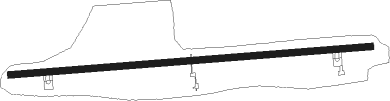
Western Islands - Pulau Sudong
Airport details
| Country | Singapore |
| State | [Other] |
| Region | |
| Airspace | Singapore Ctr |
| Municipality | Southwest |
| Elevation | 2ft (1m) |
| Timezone | GMT +8 |
| Coordinates | 1.18375, 103.72177 |
| Magnetic var | |
| Type | land |
| Available since | X-Plane v10.40 |
| ICAO code | XWSPS |
| IATA code | n/a |
| FAA code | n/a |
Communication
Nearby Points of Interest:
Tan Teck Guan Building
-College of Medicine Building, Singapore
-Singapore Conference Hall
-Sri Mariamman Temple, Singapore
-Old Ministry of Labour Building
-Yueh Hai Ching Temple
-The Chinese High School Clock Tower Building
-Old Hill Street Police Station
-Chesed-El Synagogue
-House of Tan Yeok Nee
-Central Fire Station, Singapore
-Old Supreme Court Building, Singapore
-City Hall, Singapore
-Old Tao Nan School
-MacDonald House
-Cathedral of the Good Shepherd
-Maghain Aboth Synagogue
-Church of Saints Peter and Paul
-Saint Joseph's Church
Runway info
| Runway 09 / 27 | ||
| length | 2516m (8255ft) | |
| bearing | 90° / 270° | |
| width | 45m (148ft) | |
| surface | asphalt | |
| displ threshold | 222m (728ft) / 212m (696ft) | |
Nearby beacons
| code | identifier | dist | bearing | frequency |
|---|---|---|---|---|
| SJ | SINJON (SINGAPORE) VOR/DME | 8.2 | 74° | 113.50 |
| TNG | TENGAH (SINGAPORE) TACAN | 12.6 | 357° | 113.90 |
| AG | SEMBAWANG (SINGAPORE) NDB | 15.6 | 23° | 325 |
| PLA | PAYA LEBAR (SINGAPORE) TACAN | 16.2 | 45° | 116.30 |
| SEL | SELETAR (SINGAPORE) NDB | 16.4 | 33° | 220 |
| JB | JAYBEE (JOHOR BAHRU) NDB | 18.9 | 358° | 400 |
| PU | PAPA UNIFORM (SINGAPORE) VOR/DME | 19.1 | 41° | 115.10 |
| TG | TANJUNG BALAI KARIMUN NDB | 21.3 | 248° | 410 |
| VTK | TEKONG (SINGAPORE) VOR/DME | 22.7 | 52° | 116.50 |
| BM | BATAM NDB | 23.6 | 99° | 370 |
| BTM | BATAM VOR/DME | 25 | 96° | 116 |
| KK | KONG KONG (JOHOR BAHRU) NDB | 25.9 | 38° | 286 |
| VJB | JOHOR BAHRU VOR/DME | 29 | 353° | 112.50 |
| JR | JOHOR BAHRU NDB | 29.6 | 353° | 245 |
| TPG | TANJUNG PINANG VOR/DME | 50.4 | 109° | 114.80 |
| TI | TANJUNG PINANG NDB | 50.8 | 108° | 385 |
| AP | KLUANG NDB | 57.3 | 334° | 331 |
Disclaimer
The information on this website is not for real aviation. Use this data with the X-Plane flight simulator only! Data taken with kind consent from X-Plane 12 source code and data files. Content is subject to change without notice.