Tonimbuk - Bunyip
Airport details
| Country | Australia |
| State | Victoria |
| Region | YM |
| Airspace | Melbourne Ctr |
| Municipality | Melbourne |
| Elevation | 273ft (83m) |
| Timezone | GMT +11 |
| Coordinates | -38.00981, 145.74995 |
| Magnetic var | |
| Type | land |
| Available since | X-Plane v10.40 |
| ICAO code | XY000C |
| IATA code | n/a |
| FAA code | n/a |
Communication
| Bunyip CTAF | 120.000 |
Nearby Points of Interest:
Korumburra railway station
-Baw Baw National Park
-Waverley Park
-Wilks Creek Bridge
-Western Port
-Pound Bend Tunnel
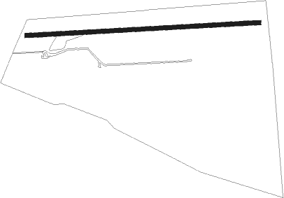
Runway info
| Runway 09 / 27 | ||
| length | 1014m (3327ft) | |
| bearing | 91° / 271° | |
| width | 18m (58ft) | |
| surface | grass | |
| displ threshold | 124m (407ft) / 78m (256ft) | |
Nearby beacons
| code | identifier | dist | bearing | frequency |
|---|---|---|---|---|
| MB | MOORABBIN (MELBOURNE) NDB | 31.2 | 273° | 398 |
| LTV | LATROBE VALLEY NDB | 36.2 | 105° | 486 |
| ML | MELBOURNE VOR/DME | 47.9 | 291° | 114.10 |
Disclaimer
The information on this website is not for real aviation. Use this data with the X-Plane flight simulator only! Data taken with kind consent from X-Plane 12 source code and data files. Content is subject to change without notice.