Kagaru
Airport details
| Country | Australia |
| State | Queensland |
| Region | YB |
| Airspace | Brisbane Ctr |
| Municipality | Scenic Rim Regional |
| Elevation | 158ft (48m) |
| Timezone | GMT +10 |
| Coordinates | -27.85054, 152.92799 |
| Magnetic var | |
| Type | land |
| Available since | X-Plane v10.40 |
| ICAO code | XY0022 |
| IATA code | n/a |
| FAA code | n/a |
Communication
| Kagaru CTAF | 126.700 |
Nearby Points of Interest:
Beaudesert War Memorial
-St John's Church, Mundoolun
-Old Logan Village State School
-Wyambyn
-Nindooinbah Homestead
-Tamborine Mountain Road
-The Park Centre for Mental Health
-United Welsh Church, Blackstone
-Bethania Lutheran Church
-Boonah Post Office
-Booval House
-Fairy Knoll
-Boonah War Memorial
-Lahey's Canungra Sawmill Complex
-Garowie
-Ipswich Mental Hospital
-Ipswich Club House
-Normanby Homestead
-Kyeewa
-Old Ipswich Courthouse
-Lahey's Canungra Tramway Tunnel
-Queensland Woollen Manufacturing Company mill
-Ipswich Town Hall
-Penrhyn
-Railway Signal Cabin and Turntable, Ipswich
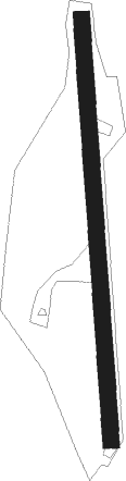
Runway info
| Runway 18 / 36 | ||
| length | 784m (2572ft) | |
| bearing | 180° / 0° | |
| width | 30m (98ft) | |
| surface | grass | |
Nearby beacons
| code | identifier | dist | bearing | frequency |
|---|---|---|---|---|
| BML | BROMELTON NDB | 7 | 193° | 374 |
| AMB | AMBERLEY TACAN | 16.8 | 315° | 108.10 |
| BN | BRISBANE VOR/DME | 31.1 | 24° | 113.20 |
| CG | GOLD COAST NDB | 35.7 | 119° | 278 |
| CG | GOLD COAST VOR/DME | 36 | 119° | 112.30 |
| BNA | BALLINA NDB | 67.9 | 147° | 206 |
Disclaimer
The information on this website is not for real aviation. Use this data with the X-Plane flight simulator only! Data taken with kind consent from X-Plane 12 source code and data files. Content is subject to change without notice.