Koksan
Airport details
| Country | North Korea |
| State | North Hwanghae |
| Region | |
| Airspace | Pyongyang Ctr |
| Municipality | Koksan County |
| Elevation | 3832ft (1168m) |
| Timezone | GMT +9 |
| Coordinates | 38.68374, 126.59205 |
| Magnetic var | |
| Type | land |
| Available since | X-Plane v10.40 |
| ICAO code | XZK19 |
| IATA code | n/a |
| FAA code | n/a |
Communication
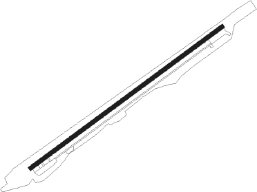
Runway info
| Runway 06 / 24 | ||
| length | 2499m (8199ft) | |
| bearing | 64° / 244° | |
| width | 42m (138ft) | |
| surface | asphalt | |
Nearby beacons
| code | identifier | dist | bearing | frequency |
|---|---|---|---|---|
| GK | PYONGYANG VOR/DME | 53.5 | 300° | 111.40 |
| YJU | YANGJU VOR/DME | 59.2 | 157° | 114.90 |
Disclaimer
The information on this website is not for real aviation. Use this data with the X-Plane flight simulator only! Data taken with kind consent from X-Plane 12 source code and data files. Content is subject to change without notice.