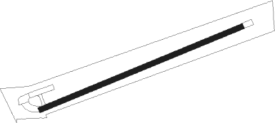
Waukon - Waukon Municipal
Airport details
| Country | United States of America |
| State | Iowa |
| Region | |
| Airspace | Minneapolis Ctr |
| Municipality | Waukon |
| Elevation | 1278ft (390m) |
| Timezone | GMT -6 |
| Coordinates | 43.27945, -91.47385 |
| Magnetic var | |
| Type | land |
| Available since | X-Plane v10.40 |
| ICAO code | Y01 |
| IATA code | UKN |
| FAA code | Y01 |
Communication
| Waukon Municipal CTAF | 122.900 |
Nearby Points of Interest:
Otto J. Hager House
-Old Allamakee County Courthouse
-Allamakee County Court House
-Old East Paint Creek Lutheran Church
-Frankville School
-Lansing Stone School
-Washington Prairie Methodist Church
-G. Kerndt & Brothers Office Block
-Turner Hall
-Lansing Main Street Historic District
-G. Kerndt and Brothers Elevator and Warehouses, No. 11, No.12 and No. 13
-Lansing Fisheries Building
-Cooley-Whitney House
-Highlandville School
-Fish Farm Mounds State Preserve
-Decorah Ice Cave State Preserve
-Steyer Opera House
-Milwaukee and St. Paul Railway Combination Depot
-Locust School
-Decorah Commercial Historic District
-Decorah Woolen Mill
-Norris Miller House
-Painter-Bernatz Mill
-Broadway-Phelps Park Historic District
Nearby beacons
| code | identifier | dist | bearing | frequency |
|---|---|---|---|---|
| UKN | DME | 2.7 | 271° | 116.60 |
| LSE | CROSSE DME | 37 | 20° | 108.40 |
| ODI | NODINE VORTAC | 38 | 1° | 117.90 |
| LS | MINDI (LA CROSSE) NDB | 44.4 | 16° | 272 |
| CMY | MC COY NDB | 53.5 | 52° | 412 |
| IIB | WAPSIE (INDEPENDENCE) NDB | 53.8 | 210° | 206 |
| ALO | WATERLOO VOR/DME | 59.5 | 232° | 112.20 |
| DBQ | DUBUQUE VORTAC | 62.5 | 139° | 115.80 |
| DB | ZILOM (DUBUQUE) NDB | 69.1 | 138° | 341 |
Disclaimer
The information on this website is not for real aviation. Use this data with the X-Plane flight simulator only! Data taken with kind consent from X-Plane 12 source code and data files. Content is subject to change without notice.
